Haddington to Longniddry Railway Walk
![]()
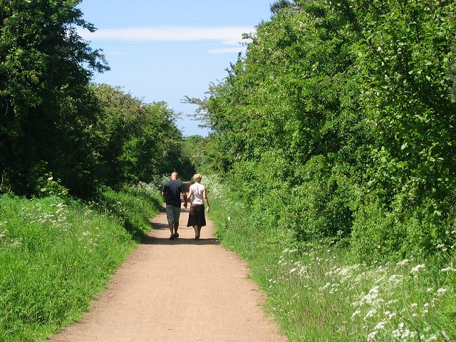
![]() This walk or cycle takes you along a dismantled railway line and National Cycle Route 76 between the East Lothian towns of Haddington and Longniddry. The route runs for about 5 miles along a nice flat path so suitable for most abilities. The line was originally opened in 1846 but closed in 1949 with the emergence of the motor car.
This walk or cycle takes you along a dismantled railway line and National Cycle Route 76 between the East Lothian towns of Haddington and Longniddry. The route runs for about 5 miles along a nice flat path so suitable for most abilities. The line was originally opened in 1846 but closed in 1949 with the emergence of the motor car.
The trail starts on the western side of Haddington where there is a public car park near to the East Lothian Community Hospital. You then head north west passing Merryhatton Cottages, the Cotty Burn and Setonhill Wood before coming into Longniddry where the route finishes at the train station.
To extend the walk you can head to the coast at Longniddry and enjoy a stroll along Gosford Sands and Seton Sands to Cockenzie and Port Seton. The Hopetoun Monument is also visible from the trail and can be climbed for fine views of the area.
Postcode
EH41 3PF - Please note: Postcode may be approximate for some rural locationsHaddington to Longniddry Railway Walk Ordnance Survey Map  - view and print off detailed OS map
Haddington to Longniddry Railway Walk Open Street Map  - view and print off detailed map
Haddington to Longniddry Railway Walk OS Map  - Mobile GPS OS Map with Location tracking
Haddington to Longniddry Railway Walk Open Street Map  - Mobile GPS Map with Location tracking
Pubs/Cafes
Joli in Longniddry is a lovely little cafe and a good choice for some post walk refreshments. They have a good range of meals and snacks and a pretty garden area to relax in if the weather is fine. You can find the cafe at 12 Main Street, Longniddry with a postcode of EH32 0NF for your sat navs.
Dog Walking
The trail makes for a fine dog walk so you'll probably see other owners on your visit.
Further Information and Other Local Ideas
The wonderful Gosford Estate is close to Longniddry. For a fee you can explore the splendid grounds surrounding the mansion.
The Haddington to East Linton Walk also starts in Haddington. It will take you to neighbouring East Linton along the River Tyne, passing the delightful Amisfield Walled Garden, the fine viewpoint at Traprain Law and the historic ruins of Hailes Castle on the way.
To the south west you'll find similar trails on the Pencaitland Railway Walk and the Penicuik to Dalkeith Railway Walk.
Dunbar is not far so you could head east to try the Dunbar Cliff Walk, the Dunbar to North Berwick Walk or visit the woodland trails at Pressmennan Wood. John Muir Country Park and the John Muir Way are also not far away.
For more walks in the area see the Edinburgh Walks page.
Cycle Routes and Walking Routes Nearby
Photos
ECML with Redhouse Castle in the background East Coast Mainline near Longniddry, with Redhouse Castle in the background. Picture taken from the Railway Walk.


