Hemsted Forest
![]()
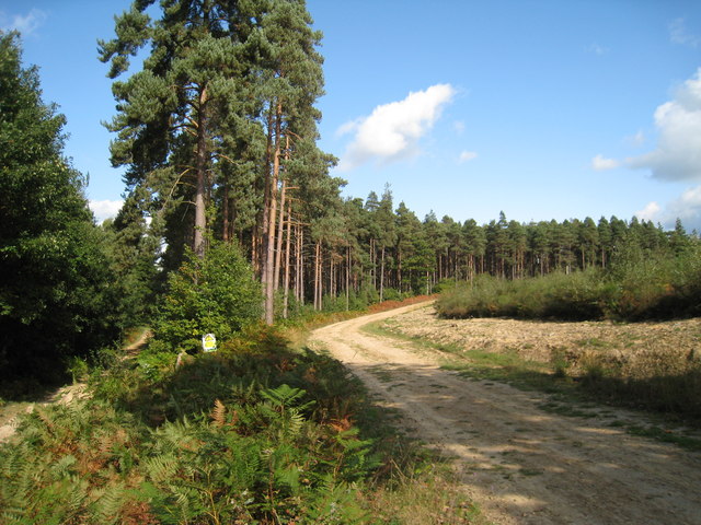
![]() This forest in Kent has mile of good walking and cycling trails taking you through attractive conifer, pine and douglas fir plantations. It's great for wildlife watching with lots of woodland birds to look out for on the way.
This forest in Kent has mile of good walking and cycling trails taking you through attractive conifer, pine and douglas fir plantations. It's great for wildlife watching with lots of woodland birds to look out for on the way.
The walk starts from the Hemsted Forest car park. It's located at the southern end of the wood, just off Goddard's Green Road at a postcode of TN17 4AN for your sat navs. It's a good sized free car park from which to start your walk. From here you can pick up public footpaths heading north through Tottenden Wood, Farningham Wood, Chittenden Wood, Causton Wood and Timber Wood. There's miles of decent walking trails and also bridleways suitable for cyclists or horse riders.
Postcode
TN17 4AN - Please note: Postcode may be approximate for some rural locationsHemsted Forest Ordnance Survey Map  - view and print off detailed OS map
Hemsted Forest Open Street Map  - view and print off detailed map
Hemsted Forest OS Map  - Mobile GPS OS Map with Location tracking
Hemsted Forest Open Street Map  - Mobile GPS Map with Location tracking
Pubs/Cafes
Just to the south is the attractive village of Benenden where you enjoy some refreshments at The Bull. The early 17th century pub is located in a pleasant spot by the village green and includes fascinating architectural features such as Chinoiserie windows, inglenook fireplaces, carved beams and lots of nooks and crannies. The antique tables and chairs, cosy rugs and cushions, low lighting, candles and antique portraits take you back hundreds of years. They serve good quality food and can be found at postcode TN17 4DE.
Dog Walking
The wide woodland trails are ideal for dog walking. You will probably see other owners on fine weekend days. The Bull mentioned above is also dog friendly.
Further Information and Other Local Ideas
The forest is located just a short distance south of the historic Sissinghurst Castle. You can reach the castle from the nearby town of Cranbrook on the Cranbrook Walk. For more woodland walking and cycling head to the expansive Bedgebury Forest which is just a few miles to the west of Hemsted.
A couple of miles to the north east there's the village of Biddenden. It's a worthy place to visit with a picturesque village green, a fine 15th century pub and a photogenic High Street with a number of old Flemish weavers cottages to admire. The Biddenden Walk visits the forest from the village on a 3 mile route via Goose Green.
For more walking ideas in the area see the High Weald Walks page.
Cycle Routes and Walking Routes Nearby
Photos
Bridleway crossroads in the forest. A bridleway (on a track) heads towards Benenden Road in Goddard Green, from the Cranbrook Road. It crosses an access road (and bridleway) heading right to Benenden Road, from Dockenden Cottage.
Bridleway in Tottenden Wood. This bridleway leads from Benenden Road, Goddard Green through Hemsted Forest to Rogley Hill. There are many pathways of the main path used by walkers from the nearby car park on Benenden Road. The bridleway is also used by cyclists.


