Holme Valley Circular Walk
![]()
![]() A circular walk through the beautiful Holme Valley, visiting a series of picturesque villages.
A circular walk through the beautiful Holme Valley, visiting a series of picturesque villages.
The walk starts at Berry Brow Railway station near Huddersfield and first heads south to Holmfirth with a lovely stretch along the River Holme at the start. Holmfirth is a popular tourist destination as it is used as the location for the Last of the Summer Wine television series.
The path then takes you around a series of beautiful reservoirs surrounding Holmbridge including Digley Reservoir, Holme Styes Reservoir, Brownhill Reservoir and Ramsden Reservoir.
A wooded section and several delightful country lanes then lead you to Hepworth. From here you head towards Thurstonland and Farnley Tyas before coming to the fascinating Castle Hill Iron Age Hill Fort.
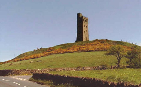
It is a Scheduled Acient Monument and the most conspicuous landmark in Huddersfield. From the summit there are wonderful panoramic views over the surrounding Kirklees countryside. The path then descends back to the finish at Berry Brow station.
This is a challenging walk with a number of ascents giving stunning views of the Holme Valley and the Holme Moss TV transmitter.
Holme Valley Circular Walk Ordnance Survey Map  - view and print off detailed OS map
Holme Valley Circular Walk Open Street Map  - view and print off detailed map
Holme Valley Circular Walk OS Map  - Mobile GPS OS Map with Location tracking
Holme Valley Circular Walk Open Street Map  - Mobile GPS Map with Location tracking
Pubs/Cafes
The Pickled Pheasant is located on the route in Holmbridge near Digley Reservoir. This fine gastro pub includes a large car park, a beer garden and a restaurant. The recently modified interior is very appealing with many original features including beautiful oak beams, stone flagged floors and two open fireplaces. They are dog friendly and also provide good quality accommodation if you need to stay over. You can find the inn at Woodhead Rd, Holmbridge with a postcode of HD9 2NQ for your sat navs.
In Farnley Tyas there's the Golden Cock to consider. The 200 year old pub has a nice interior with beamed ceilings and stone floors in some areas. Outside there's a garden area where you can relax on warmer days. They serve good quality dishes and can be found at postcode HD4 6UD for your sat navs.
In Hepworth there's the Butcher's Arms. The pub dates back to the early 1800s and includes a traditional bar with stone floors and an open fire. They serve good quality food and have a fine selection of ales.
The pub is also notable for featuring in the long running tv show Last of the Summer Wine. Many scenes from the show were shot around the village with the characters often meeting up in the pub.
You can find them at postcode HD9 1TE for your sat navs.
Cycle Routes and Walking Routes Nearby
Photos
Castle Hill, Huddersfield 1. The Victoria Tower on Castle Hill dominates the skyline to the south of Huddersfield. The hill top was once occupied by an ancient hill fort.
Elevation Profile


