Humbleton Hill Wooler Common Walk
![]()
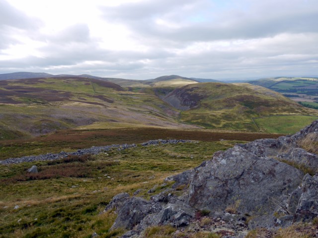
![]() Enjoy a walk to Humbleton Hill from Wooler and take in the great views over the Cheviot Hills.
Enjoy a walk to Humbleton Hill from Wooler and take in the great views over the Cheviot Hills.
The walk starts in the popular walking town of Wooler. Begin by following country lanes west out of the town to Wooler Common where you can pick up a trail along the Humbleton Burn. After about a mile you turn north, following a section of the St Cuthbert's Way past Brown's Law. You then branch to the right to pick up the trails that will take you up to the Humbleton Hill summit. Here you will find the remains of an Iron Age hillfort and splendid views towards Yeavering Bell, the Northumberland coast and the Scottish Hills.
The hill is also of historical significan being the site of the Battle of Homildon Hill fought between the English and Scottish armies in 1402.
This walk skirts the edge of Wooler Common. The common is a great place to extend your walk with woodland trails, two ponds and an easy access trail to try.
You could also continue west along the St Cuthbert's Way and visit Yeavering Bell with its a late-prehistoric Hill fort. The trail will also take you into the beautiful College Valley where you can enjoy waterside trails along the College Burn to the pretty Hethpool Linn waterfall.
Humbleton Hill Ordnance Survey Map  - view and print off detailed OS map
Humbleton Hill Open Street Map  - view and print off detailed map
*New* - Walks and Cycle Routes Near Me Map - Waymarked Routes and Mountain Bike Trails>>
Humbleton Hill OS Map  - Mobile GPS OS Map with Location tracking
Humbleton Hill Open Street Map  - Mobile GPS Map with Location tracking
Pubs/Cafes
Head into nearby Wooler and there's a good range of pubs and cafes. The Anchor Inn is a good choice with a friendly atmosphere and very good food at reasonable prices. You can find it on Cheviot St with a postcode of NE71 6LN. It's also dog friendly if you have your canine friend with you.


