Ideford Common
![]()
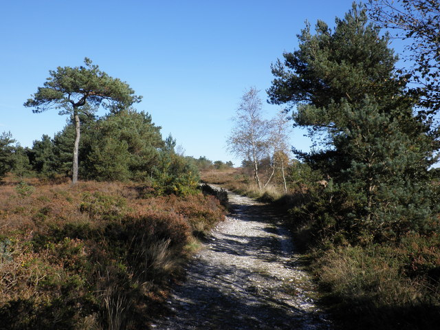
![]() This area of common land near Newton Abbot has some nice footpaths to try. The common is located just a half mile north of the Devon village if Ideford. You could start the walk from there if you like but this route starts from the car park at the northern edge of the common. From here you can pick up footpaths heading south through the woodland, heathland and grassland on the site. Look out for birdlife including nightjars and Dartford warbler as you go.
This area of common land near Newton Abbot has some nice footpaths to try. The common is located just a half mile north of the Devon village if Ideford. You could start the walk from there if you like but this route starts from the car park at the northern edge of the common. From here you can pick up footpaths heading south through the woodland, heathland and grassland on the site. Look out for birdlife including nightjars and Dartford warbler as you go.
The common is in an elevated position so there are nice views down to the village and across the broad valley of the Teign Estuary. It's a very attractive and peaceful area so you could easily spend a couple of hours strolling along the various paths. There's also the option of heading north and exploring the adjacent Haldon Forest if you have time.
To the west of the common you can pick up the River Teign Walk near Chudleigh. The long river walk explores the Teign Valley. You could follow it south, for example, to visit the Chudleigh Knighton Heath Nature Reserve.
Ideford Common Ordnance Survey Map  - view and print off detailed OS map
Ideford Common Open Street Map  - view and print off detailed map
Ideford Common OS Map  - Mobile GPS OS Map with Location tracking
Ideford Common Open Street Map  - Mobile GPS Map with Location tracking
Further Information and Other Local Ideas
Just to the west you can pick up the circular Chudleigh Walk from the nearby town. This visits some of the highlights of the area including Chudleigh Rocks, Ugbrooke Park and the Castle Dyke Iron Age Hillfort.
To the south of Newton Abbot you'll find Decoy Country Park. There's a Wildlife Discovery Centre, Nature Reserve and a watersports centre next to a pretty lake to enjoy here.
Head a few miles due south and you could pay a visit to the interesting village of Bishopsteignton. There's a ruined 14th century chapel, a small museum, a 16th century pub and fine views over the estuary in this historic settlement.
Just to the north you can explore the expansive Haldon Forest Park where you'll find some good mountain biking trails and the lovely Mamhead Sensory Trail which commands fine views over the Exe Estuary. At the northern end of the forest you will find Haldon Belvedere (Lawrence Castle). The site is used as wedding venue but is also open to the public on certain days. The fine looking castle dates from 1788 and is surrounded by some the lovely grounds and gardens. See the Doddiscombsleigh Walk for more details.
For more walking ideas in the area see the Dartmoor Walks and the Devon Walks pages.
Cycle Routes and Walking Routes Nearby
Photos
In the valley is the village of Ideford and beyond the ridge is the broad valley of the Teign estuary.


