Keld Waterfall Walk
![]()
![]() This attractive village makes a fine base for exploring the Yorkshire Dales National Park. There's some fine river paths, a number of waterfalls and a National Trail running through the area.
This attractive village makes a fine base for exploring the Yorkshire Dales National Park. There's some fine river paths, a number of waterfalls and a National Trail running through the area.
This circular walk from the village visits a series of pretty waterfalls and includes a stretch along the Pennine Way National Trail which runs through the area.
The route visits Kisdon Force, East Gill and Catrake Force before an optional extension to Wain Wath Force which lies just to the north west of the settlement. Along the way there's also nice riverside paths along the Swale and a visit to the neighbouring village of Muker. The return leg runs along an elevated section of the Pennine Way with fine views to enjoy from the high points.
Please scroll down for the full list of walks near and around Keld. The detailed maps below also show a range of footpaths, bridleways and cycle paths in the area.
Postcode
DL11 6LL - Please note: Postcode may be approximate for some rural locationsKeld Ordnance Survey Map  - view and print off detailed OS map
Keld Open Street Map  - view and print off detailed map
*New* - Walks and Cycle Routes Near Me Map - Waymarked Routes and Mountain Bike Trails>>
Keld OS Map  - Mobile GPS OS Map with Location tracking
Keld Open Street Map  - Mobile GPS Map with Location tracking
Pubs/Cafes
Back in the village head to the Keld Lodge for some post walk refreshment. The fine stone building dates back to 1860 when it was originally a shooting lodge. Today it is a top quality hotel and restaurant with wonderful views over Swaledale.
Dog Walking
The riverside, woodland and country trails make for a fine dog walk. The Keld Lodge mentioned above is also dog friendly.
Further Information and Other Local Ideas
The Keld to Ravenseat Walk is another popular one to try from the village. It will take you up to a lovely viewpoint with an old clapper bridge and the photogenic Jenny Whalley Force waterfall.
For more walking ideas in the area see the Yorkshire Dales Walks page.
Cycle Routes and Walking Routes Nearby
Photos
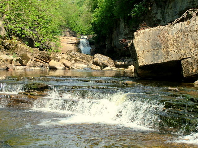
Kisdon Force waterfall on River Swale. Bottom of a series of waterfalls that make up Kisdon Force on the River Swale. The lower part of the falls shown here is difficult to access unless the water level is quite low.


