Walks in Kettering
![]()
![]() This walk from the Northamptonshire town of Kettering takes you along the River Ise to the nearby Boughton House.
This walk from the Northamptonshire town of Kettering takes you along the River Ise to the nearby Boughton House.
The walk starts on the eastern fringes of the town where you can pick up a public footpath and follow it north toward Warkton, with a riverside footpath along the way. The walk continues north west through Weekley before coming to Boughton Park. There's nice views from the footpath over the estate which is open at certain times of the year (typically bank holiday weekends in the summer months). Inside the grounds you will find 18th-century landscaped gardens, woodlands and a grand country park. The house is also stunning being labelled ‘The English Versailles’. Inside you'll find one of Britain’s most outstanding collections of fine art, furniture, tapestries, porcelain and carpets. There's also paintings by El Greco and Gainsborough in the extensive art gallery.
After enjoying the views of the park you can return to Kettering along the same paths. You could also continue along the roadside to Geddington if you have time.
Postcode
NN16 8DH - Please note: Postcode may be approximate for some rural locationsKettering Ordnance Survey Map  - view and print off detailed OS map
Kettering Open Street Map  - view and print off detailed map
Kettering OS Map  - Mobile GPS OS Map with Location tracking
Kettering Open Street Map  - Mobile GPS Map with Location tracking
Walks near Kettering
- Thrapston - This walk from the Northamptonshire town of Thrapston takes you along the River Nene to the neighbouring village of Wadenhoe
- Titchmarsh Nature Reserve - Enjoy waterside walking in this nature reserve in Thrapston, near Kettering
- Barnwell Country Park - Enjoy lovely waterside walking trails in this country park in Oundle, Northamptonshire
- Nene Way - Follow the River Nene through the beautiful Nene Valley on this fabulous walk through Cambridgeshire, Lincolnshire and Northamptonshire.
The long distance path runs for over 100 miles, passing Northampton, Wellingborough, Oundle, Peterborough and Wisbech.
There's much to enjoy on the way with rushing weirs, a series of historic villages and old mills - Stanwick Lakes - Explore 750 acres of parkland and nature reserve in the heart of Northamptonshire's beautiful Nene Valley
- Fermyn Woods - This country park and forest has a number of walking trails and two bridleways for cyclists
- Cransley Reservoir - This walk visits Cransley Reservoir from the village of Thorpe Malsor in Northamptonshire.
- Ringstead - This circular walk explores the countryside and neighbouring villages around the Northamptonshire village of Ringstead.
- Orlingbury - This Northamptonshire based village is located near the towns of Kettering and Wellingborough.
- Grafton Underwood - This walk visits the pretty Northamptonshire village of Grafton Underwood
Pubs/Cafes
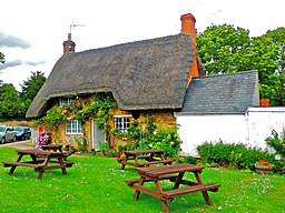
The Peacock is a good choice for some post walk refreshments. They serve good quality food and have a great garden area as well. You can find them at Lower Street with postcode NN16 8DH for your sat navs.
Further Information and Other Local Ideas
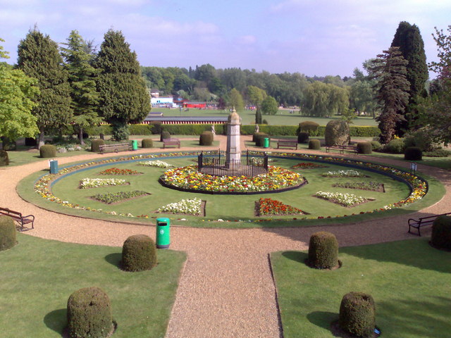
For more walks in Kettering head to Wicksteed Park on the southern fringes of the town. There's pretty gardens and a nice lake to stroll around here. You can find the park at Barton Road with a postcode of NN15 6NJ for your sat navs.
Head east from the town and you can visit Thrapston where you'll find the Titchmarsh Nature Reserve. There's several lakes and lots of wildlife to see here. You can also pick up the Nene Way in this area and enjoy riverside walks along the River Nene.
Just to the south are the villages of Orlingbury and Little Harrowden where you will find a noteworthy church dating back to the 12th century.
For more walking ideas in the area see the Northamptonshire Walks page.
Photos
Variety of roofing materials, Weekley, Northants Three 'traditional' materials in a row: clay pantiles in the foreground, thatch on the cottages and Collyweston 'slate' in the distance. This 'slate' is in fact a variety of Jurassic limestone, and gets its name from the village of Collyweston SW of Stamford, Lincs,


