Killin Railway Viaduct Walk
![]()
![]() This popular Perthshire village is located in a fine spot at the western end of Loch Tay in the Loch Lomond and the Trossachs National Park.
This popular Perthshire village is located in a fine spot at the western end of Loch Tay in the Loch Lomond and the Trossachs National Park.
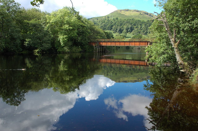
This walk from the village takes you along a section of the old railway. On the way you will pass the Killin Viaduct and enjoy some fine views of the River Dochart and the historic Finlarig Castle.
Start the walk near the Falls of Dochart where there's a pub and car parking available. From here you can pick up a trail heading north east over the river Dochart to the Bridge of Lochay. On the way you will also cross another bridge over the River Lochay before coming to the photogenic ruins of Finlarig Castle. The trail is also suitable for cyclists.
You'll also pass close to the western edge of Loch Tay where there are more waterside walking and cycling opportunites.
To continue your exercise along the old railway pick up the Killin to Callander route which will take you west through Glen Ogle to Loch Earn and Callander.
Killin Ordnance Survey Map  - view and print off detailed OS map
Killin Open Street Map  - view and print off detailed map
Killin OS Map  - Mobile GPS OS Map with Location tracking
Killin Open Street Map  - Mobile GPS Map with Location tracking
Walks near Killin
- Loch Tay - Enjoy a short walk to Loch Tay from the town of Killin in the Loch Lomond and the Trossachs National Park
- Falls of Dochart - This short walk takes you from the village of Killin to the beautiful Falls of Dochart
- Rob Roy Way - Follow in the footsteps of Robert Roy MacGregor, famous Scottish folk hero and outlaw of the early 18th century
- Ben Lawers - Ben Lawers is one of the most popular climbs in Scotland due to the beauty of the surrounding area
- Glen Ogle - This lovely cycling and walking trail takes you along National Cycle Route 7 through the beautiful Glen Ogle
- Loch Earn - Explore the eastern end of Loch Earn and climb to a lovely viewpoint on this short walk
- Loch Freuchie - This walk visits Loch Freuchie in Glen Quaich in Perth and Kinross.
- Killin to Callander - Travel through the beautiful Loch Lomond and Trossachs National Park along National Cycle Route 7 on this stunning cycle ride
Pubs/Cafes
At the start of the walk there's the Falls of Dochart Inn for some post walk refreshments. The inn is set in a great location next to the falls. You can sit outside and relax listening to the rushing water. Inside there's a cosy interior with a wood burning fire for colder weather. The inn has some history too, dating all the way back to the 1700s when it was previously a blacksmiths. You can find the inn at postcode FK21 8SL for your sat navs.


