Kirkby Stephen River Circular Walk
![]()
![]() This circular walk takes you along a section of the Pennine Journey long distance trail before returning along the River Eden.
This circular walk takes you along a section of the Pennine Journey long distance trail before returning along the River Eden.
The small market town of Kirkby Stephen is located in Cumbria, near the border of the Yorkshire Dales National Park. It's surrounded by some lovely countryside, with the rolling hills and the River Eden to admire. The Pennine Journey waymarked trail runs through the area and provides a link to the river for walkers.
The walk starts in the centre of the town and heads east along the river towards Frank's Bridge and Hartley Castle. The path turns south and continues towards the village of Nateby where you could pause for refreshments at the nice country pub.
Just after Nateby you cross the river and turn north passing Stenkrith Park where the river scenery changes from limestone at the head of the Eden Valley in Mallerstang, to the red sandstone which is characteristic further along the Eden Valley. The river at Stenkrith has carved this rock into many fantastic shapes, collectively known as the Devil's Grinding Mill or Devil's Hole. Also look out for the ten 'Eden Benchmarks', a series of sculptures that have been placed at intervals along the River Eden from its source in Mallerstang to the Solway Firth.
The walk continues along the river passing Stenkrith Hill before returning to the town.
To continue your walking in the Kirkby Stephen area, you could try the climb to Nine Standards Rigg. From the 662 m (2,172 ft) summit of the hill you can enjoy wonderful views over the Eden Valley.
You can also continue along the Pennine Journey. Follow it south and it will take you along the river to the atmospheric ruins of the 12th century Pendragon Castle in the striking Mallerstang Valley.
Just on from here you can enjoy another climb to Wild Boar Fell. One of the highest fells in the Yorkshire Dales, it commands fabulous views over the Eden Valley. Around here you can also pick up the long distance Pennine Bridleway.
If you head south west you can visit the impressive Smardale Gill Viaduct and visit the pretty village of Ravenstonedale. There's lovely walks here along the Scandale Beck and through the Smardale Nature Reserve.
Kirkby Stephen River Circular Ordnance Survey Map  - view and print off detailed OS map
Kirkby Stephen River Circular Open Street Map  - view and print off detailed map
Kirkby Stephen River Circular OS Map  - Mobile GPS OS Map with Location tracking
Kirkby Stephen River Circular Open Street Map  - Mobile GPS Map with Location tracking
Pubs/Cafes
The Black Bull Hotel is a good choice for some post walk refreshments. They do good food and also have a nice beer garden if the weather is good. You can find them at 38 Market Street with a postcode of CA17 4QW for your sat navs.
Dog Walking
The country and river trails on the route make for a fine dog walk. The Black Bull mentioned above is also dog friendly.
Further Information and Other Local Ideas
Head north and you will soon come to the interesting town of Brough. Here you'll find the historic ruins of the 11th century Brough Castle and some nice trails along the Swindale Beck.
A few miles to the west there's the nearby village of Tebay where you will find riverside trails along the River Lune. The village is also known for its 16th century pub and the Tebay Motorway Services.
Cycle Routes and Walking Routes Nearby
Photos
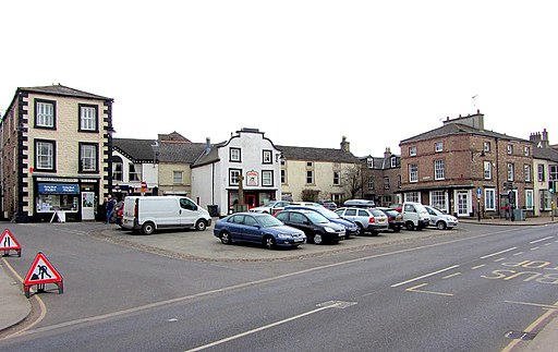
Looking north along the A685 Kendal - Brough road as it passes through this small market town. The town has a good variety of shops including multiple antique shops, restaurants, cafés, pubs, and an Upper Eden Visitor Centre. The town has also won several awards from Britain in Bloom for its attractive nature.
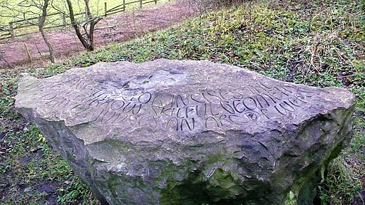
July Poem on Poetry Path. Another nice walking option in the town this literary path has 12 stones, which were carved by the artist Pip Hall. They bear poems by Meg Peacock that depict a year in the life of a hill farmer.
Kirkby Stephen Parish Church. The church is of some note, dating back to the 13th century and described as the "Cathedral of the Dales". It is a Grade II* listed building.


