Lairg And Loch Shin Walk
![]()
![]() The large village of Lairg is located in Sutherland in the Northern Highlands at the southern end of the beautiful Loch Shin.
The large village of Lairg is located in Sutherland in the Northern Highlands at the southern end of the beautiful Loch Shin.
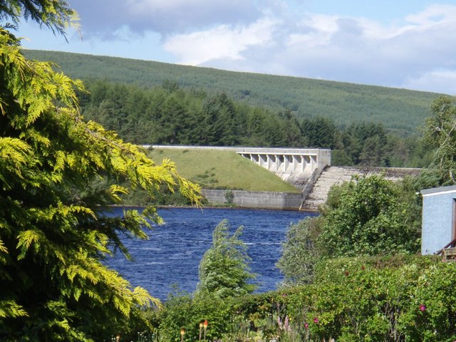
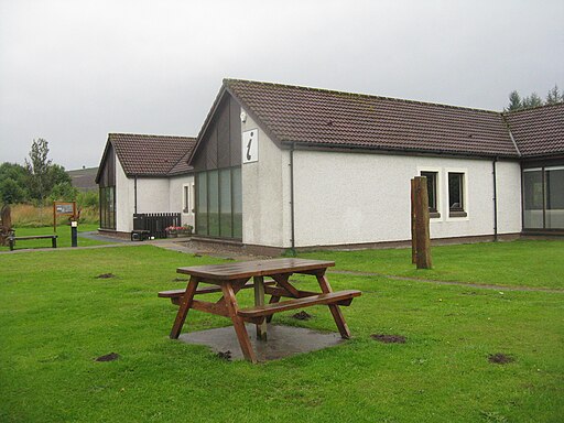
This circular walk starts from the Ferrycroft Visitor Centre & Information Point on the western side of Little Loch Shin. The handy centre includes lawned gardens with wood carvings, seating and play area. From here you can follow footpaths through Ferry Wood to the impressive Loch Shin Hydro Dam. The impressive dam makes a fine photo with the backdrop of the surrounding hills.
To continue your walking around Lairg head south to visit the splendid Falls of Shin. Here you can look out for the leaping salmon and enjoy a woodland walk through the adjacent Shin Forest. The site also includes an informative visitor centre and a cafe.
Postcode
IV27 4AZ - Please note: Postcode may be approximate for some rural locationsLairg Ordnance Survey Map  - view and print off detailed OS map
Lairg Open Street Map  - view and print off detailed map
Lairg OS Map  - Mobile GPS OS Map with Location tracking
Lairg Open Street Map  - Mobile GPS Map with Location tracking
Walks near Lairg
- Falls of Shin - This circular walk visits the beautiful Falls of Shin in the north of Scotland
- Ben Bhraggie - This circular walk climbs Ben Bhraggie hill in Golspie
- Loch Brora - This beautiful loch is located a few miles north west of the coastal village of Brora in n the east of Sutherland, in the Highland area of Scotland
- Loch Fleet - This walk visits the wonderful Loch Fleet National Nature Reserve near Golspie and Dornoch.
- Loch Assynt - This walk visits ruins of Ardvreck Castle on the shores of Loch Assynt near Lochinver, Sutherland
- Eas a' Chual Aluinn - This walk takes you to the highest waterfall in Britain
- Lochinver River Walk - This pleasant riverside walk takes you along the River Inver in the Assynt district of Sutherland, Highland.
- Dornoch to Embo - This walk follows a popular section of the John O' Groats Trail from Dornoch To Embo on the Sutherland coast.
- Brora to Golspie - This walk follows a section of the John O' Groats trail from Brora to Golspie.
- Golspie Big Burn - This delightful circular walk takes you through a lovely wooded gorge in Golspie, Sutherland
- Knockan Crag - This walk visit the wonderful Knockan Crag National Nature Reserve within the North West Highlands Geopark in the Assynt region of Scotland.
Pubs/Cafes
The Pier Cafe is in a fine location overlooking Loch Shin. They have a decking area where you can enjoy a delicious meal with fine views over the water. The cafe can be found at postcode IV27 4EG for your sat navs.
Photos
Countryside Centre at Lairg. Two walks start from Ferrycroft, the first is the Ord Hill Archaeological Trail (hut circles, burnt mound, chambered cairns), the other walk is Ferrywood with a ruined broch, views of Shin Dam and lochside path. There are three separate display rooms covering “Water”, “Land” and “People” plus at times additional, temporary features (e.g. Local History Society). For the younger ones there is an animal hide and seek, colouring, “Nature Detective” questions and games.
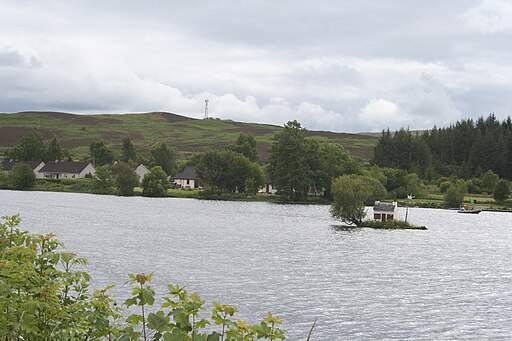
Little Loch Shin and Broon's Hoos. Little Loch Shin lies directly in the centre of the village. It is a manmade loch created by the hydroelectric dam scheme, and is the home of the "Broon's hoose", a small, wooden dwelling on an islet. Loch Shin itself lies to the north of Lairg and is 17 miles (27 km) long.
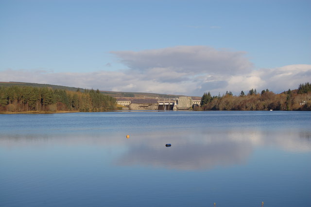
Loch Shin from Lairg. Loch Shin lies to the north of Lairg and is 17 miles (27 km) long. Around the loch there are mountain ranges; the 3,273-foot (998-metre) Ben More Assynt in the west and Ben Klibreck (3,154 ft or 961 m) to the east. The loch drains to the North Sea by way of the short River Shin that feeds into the Dornoch Firth at Bonar Bridge.
Lairg railway station lies on the picturesque Far North Line, north of Invershin and west of Rogart. It is managed by ScotRail. Four Inverness to Wick via Thurso trains call here each way on weekdays and Saturdays (along with a fifth Inverness departure southbound in the early morning) and a single departure each way on Sundays.

