Llangennith to Rhossili Walk
![]()
![]() This walk takes you along the coast from Llangennith to Rhossili in the Gower.
This walk takes you along the coast from Llangennith to Rhossili in the Gower.
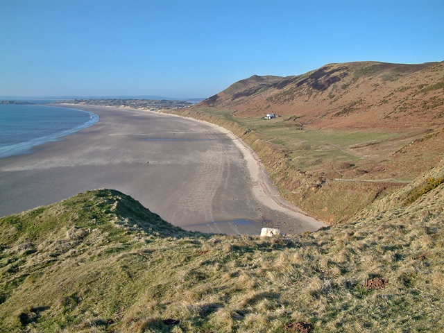
It's about a 3 mile walk, passing along the beach and cliff tops at Rhossili Bay with sand dunes and wonderful views throughout.
The walk can be started from the Llangennith Burrows car park just to the west of the village of Llangennith. You can then follow trails south through the stunning National Trust owned area.
The walk can be extended by heading up onto Rhossili Downs for more excellent views over the area.
Llangennith to Rhossili Walk Ordnance Survey Map  - view and print off detailed OS map
Llangennith to Rhossili Walk Open Street Map  - view and print off detailed map
Llangennith to Rhossili Walk OS Map  - Mobile GPS OS Map with Location tracking
Llangennith to Rhossili Walk Open Street Map  - Mobile GPS Map with Location tracking
Pubs/Cafes
The Lookout cafe is located in a splendid spot in Rhossili at the end of the walk. They serve a good range of meals, snacks and sweet treats. You can sit outside and enjoy a wonderful view over the bay with your meal. You can find them at 1 Bay View, SA3 1PN. They are dog friendly.
Cycle Routes and Walking Routes Nearby
Photos
Sandy beach and waders. There's three miles or so of superb beach stretching northwards from Rhossili to Llangennith Burrows. Worms Head in the distance.


