Lullingstone Country Park
![]()
![]() Explore 460 acres of parkland in this large open space in the Darenth Valley of Kent. Located between Eynsford and Shoreham, Lullingstone contains several waymarked walking trails of varying lengths.
Explore 460 acres of parkland in this large open space in the Darenth Valley of Kent. Located between Eynsford and Shoreham, Lullingstone contains several waymarked walking trails of varying lengths.
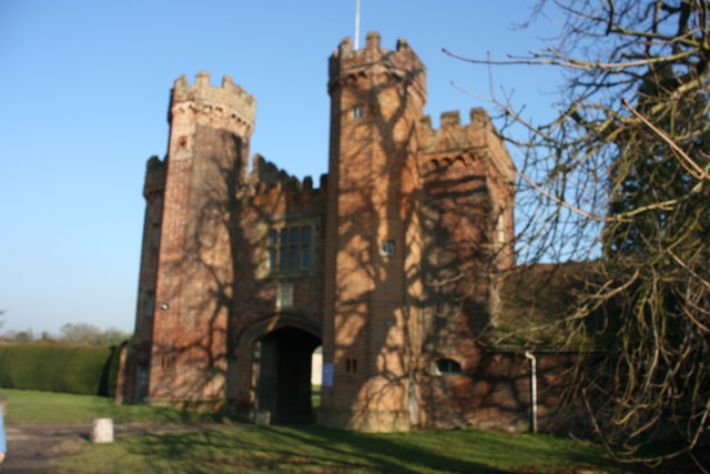
The park is well known for its large collection of ancient trees including oaks, beeches, hornbeams, ash and sweet chestnut, some of which are around 500 years old. Also of interest is the 15th Century Lullingstone Castle, Tom Hart Dyke's World of Garden Plants and Lullingstone Roman Villa with its spectacular mosaics and Roman wall paintings.
If you wish to continue your walk then the Darent Valley Path runs through the park along the River Darent. You can pick up the trail on the eastern side of the park near the castle. Following it south will take you to Shoreham, Otford and Sevenoaks. Head north and you will come to Horton Kirby and Dartford.
Our Eynsford Circular Walk visits Eynsford Castle ruins before taking you through the park and along the river. It's another good option for exploring the area around the park.
Postcode
DA4 0JF - Please note: Postcode may be approximate for some rural locationsPlease click here for more information
Lullingstone Country Park Ordnance Survey Map  - view and print off detailed OS map
Lullingstone Country Park Open Street Map  - view and print off detailed map
Lullingstone Country Park OS Map  - Mobile GPS OS Map with Location tracking
Lullingstone Country Park Open Street Map  - Mobile GPS Map with Location tracking
Pubs/Cafes
The park has its own cafe in the visitor centre that serves delicious homemade food and fresh coffee. You could venture into one of the nearby villages though if you prefer. In nearby Shoreham there are two historic 16th century pubs of some note. The Kings Arms is a traditional pub with low ceilings, history on the walls and a garden area. You can find it on Church St, with a postcode of TN14 7SJ. Also on Church Street is Ye Olde George Inn. It's dog friendly and also has a great history attached to it.
There's a few good options for refreshments in Eynsford too. The Riverside Tea Room is in a great location for some afternoon tea. There's a good menu and outdoor seating for warmer days. You can find it at postcode DA4 0AE.
The Malt Shovel is another nice choice. The friendly pub does great food and also has a nice beer garden to relax in. You can find it at postcode DA4 0EP your sat navs.
Dog Walking
The park is great for dog walking so you'll probably see plenty of other owners on your visit. There are lots of off lead areas but you are asked to keep them on leads around the car park, café and play area. There is a tap for dog drinking water at the main entrance to the visitor centre and drinking bowls are provided by the café.
Further Information and Other Local Ideas
Just a couple of miles to the south east there's nearby Kemsing where you can explore the Kemsing Downs Nature Reserve. It's a lovely place for a walk with ancient woodland, bluebells, wildlife and more tremendous views from its elevated location.
Cycle Routes and Walking Routes Nearby
Photos
The River Darent from the Darent Valley Path. The large park is internationally important for its collection of ancient trees, with over 300 veteran oak, beech, ash, hornbeam and sweet chestnut, some of which are thought to be 800 years old. There are also areas of chalk grassland that fill with spectacular displays of orchids and other wild flowers in spring and summer. The visitor centre on site offers excellent facilities including a café, toilets and shop. It has a comprehensive range of information about the park's landscape, wildlife and heritage. For those wishing to venture into the wider countryside, an excellent guide is available for a 6.5 mile circular walk from the visitor centre, passing through the nearby village of Shoreham. At Lullingstone a fully equipped education centre enables groups of all ages, from primary schools to adult art and conservation groups, to learn about all aspects of the countryside.
The Gatehouse, Lullingstone Castle, Lullingstone Country Park. Lullingstone Castle is one of England’s oldest family estates, dating back to the time of Domesday. The present Manor House and Gate house were built in 1497 and have been home to the same family ever since. Both Henry VIII and Queen Anne are known to have been regular visitors.


