Lymm Dam Walk
![]()
![]() Enjoy an easy waterside walk around this pretty lake in the Cheshire village of Lymm. The beautiful still waters of the lake are surrounded by attractive woodland with well maintained paths to follow. There is usually plenty of roadside parking around the dam and an ice cream van for refreshments.
Enjoy an easy waterside walk around this pretty lake in the Cheshire village of Lymm. The beautiful still waters of the lake are surrounded by attractive woodland with well maintained paths to follow. There is usually plenty of roadside parking around the dam and an ice cream van for refreshments.
Start the walk by the Dingle near the canal and then head south to follow the 1 mile path around the water. You could also continue south along the woodland trails along the Bradley Brook to extend the walk.
The Cheshire Ring Canal Walk and the Mersey Valley Timberland Trail both run to the north of the dam. You can easily pick up these trails to explore the Bridgewater Canal around the village. Heading west will take you to nearby Warrington, while heading east will take to Altrincham via the splendid Dunham Massey. There's some lovely trails to try here with a magnificent deer park, a 17th century mill and the tranquil Island and Smithy pools. See the Canal Walk Lymm to Dunham Massey page for more details.
Postcode
WA13 9NJ - Please note: Postcode may be approximate for some rural locationsLymm Dam Ordnance Survey Map  - view and print off detailed OS map
Lymm Dam Open Street Map  - view and print off detailed map
*New* - Walks and Cycle Routes Near Me Map - Waymarked Routes and Mountain Bike Trails>>
Lymm Dam OS Map  - Mobile GPS OS Map with Location tracking
Lymm Dam Open Street Map  - Mobile GPS Map with Location tracking
Pubs/Cafes
There's lots of good pubs in the town but you could also head up to the Bridgewater Way and visit the Golden Fleece where there's a lovely, large canalside beer garden. It's a great place to sit and watch the boats go by on a summer day. You can find them at a postcode of WA13 0HR for your sat navs.
Further Information and Other Local Ideas
Just to the north of the village, on the other side of the Manchester Ship Canal, you can pick up the Glazebrook Trail. This easy waymarked footpath runs along the River Glaze towards Wigan.
Just a few miles to the south there's Arley Hall to visit. Here you'll find a fine stately home surrounded by beautiful parkland and gardens.
For more walking ideas in the area see the Cheshire Walks page.
Cycle Routes and Walking Routes Nearby
Photos
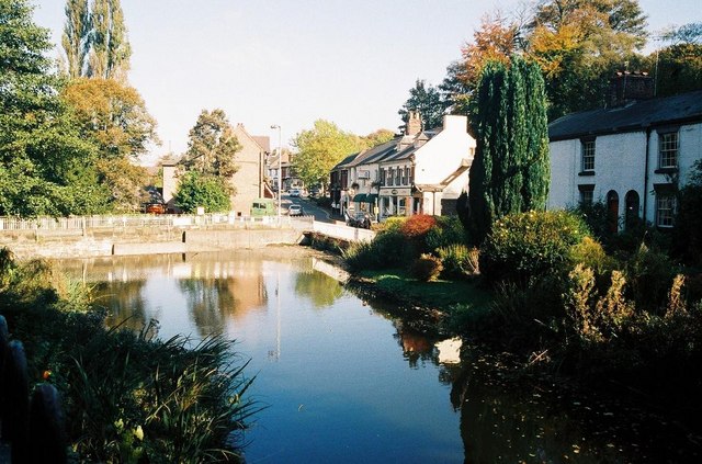
Lymm Dam. The dam was created in 1824 and may have been used to supply power to local industry, and the surrounding area. It is now a popular visitor attraction.
Into the sun at the Dingle. The village transitioned from its agricultural roots during the Industrial Revolution, when the arrival of the Bridgewater Canal and the Warrington and Altrincham Junction Railway spurred industrial growth. The village played a key role in several industries, particularly salt extraction, gold beating, and cotton, with many residents involved in fustian cutting—a craft related to cotton fabric production.
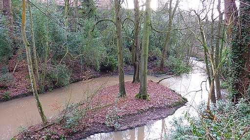
The Dingle. Lymm has retained much of its historical charm, with the village centre designated as a conservation area. Notable buildings include St Peter's Church, Lymm Hall, and Oughtrington Hall, once the seat of the Leigh family and now part of Lymm High School. Another historical site, Lymm Cross, is a Grade I listed structure from the 17th century. The village also houses an ancient "dinosaur" footprint from the Triassic period, discovered in one of its quarries.
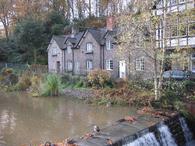
The Dingle overlooking the weir and pond in Lymm centre. In modern times, Lymm has become a sought-after residential area, recognised in 2017 as one of the 'Best Places to Live' by The Times and The Sunday Times. It balances historical significance with a strong sense of community, exemplified by recreational spaces like Spud Wood, managed by the Woodland Trust and located near the Bridgewater Canal.


