Walk Around Malton
![]()
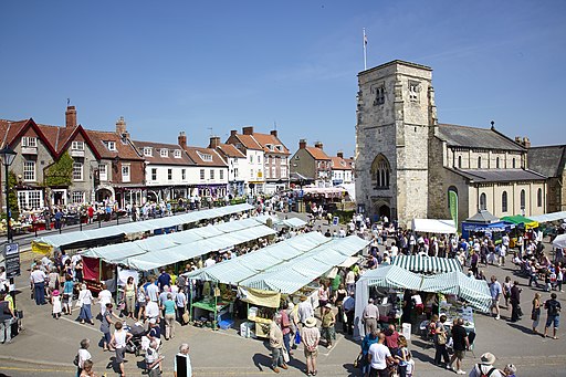
![]() This attractive market town in North Yorkshire has nice footpaths to follow through Malton Castle Gardens and along the River Derwent. There's also the Roman fort at Orchard Fields, historic buildings and a lovely market place.
This attractive market town in North Yorkshire has nice footpaths to follow through Malton Castle Gardens and along the River Derwent. There's also the Roman fort at Orchard Fields, historic buildings and a lovely market place.
Start your walk in the town centre and head east past the Lodge to the Malton Castle Gardens and the Roman Fort.
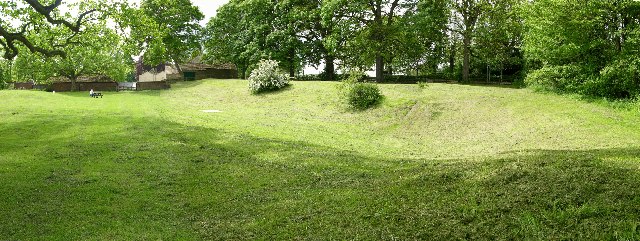
The lovely 5 acre gardens have a number of interesting flowers, plants and trees to see. They are located on the site of a historic castle. All that remains of the castle is a street name and a few remnants of wall.
The Roman fort of Derventio Brigantum is of some note. It dates from 71AD and included large, elaborate dwellings with heated floors, baking ovens, workshops and storehouses, and even a bath house. Excavations have revealed pottery, jet jewellery and coinage. A plaque recording the excavations by Philip Corder in the late 1920s can be found on the site.
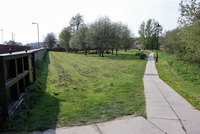
After exploring the site you can cross the river and pick up a footpath along the Derwent.
The Centenary Way long distance trail runs through the town so there is scope for extending your walking in the area. You could follow the trail south along the River Derwent to the atmospheric ruins of Kirkham Abbey.
Following it east will take you over the river to Norton-on-Derwent and then through the countryside to Settrington.
The town sits on the edge of the Howardian Hills AONB where there's numerous fine walking trails to try.
For example if you head a few miles to the west you can visit the splendid Castle Howard near Welburn. Here you'll find 1000 acres of parkland and gardens surrounding a fine stately home.
You could also visit the nearby village of Terrington which is another great base for exploring the beautiful countryside of the Howardian Hills.
Malton Ordnance Survey Map  - view and print off detailed OS map
Malton Open Street Map  - view and print off detailed map
Malton OS Map  - Mobile GPS OS Map with Location tracking
Malton Open Street Map  - Mobile GPS Map with Location tracking
Walks near Malton
- Centenary Way Yorkshire - Explore the Howardian Hills and the Yorkshire Wolds on this splendid walk devised to celebrate the 100th anniversary of Yorkshire County Council
- Castle Howard - The 1000 acres of parkland and gardens surrounding this stately home is a walker's paradise
- Terrington - Terrington is a delightful village in the Howardian Hills near to Castle Howard
- Nunnington and the River Rye - This pretty village on the fringe of the Howardian Hills includes the National Trust owned Nunnington Hall and nice footpaths along the River Rye which runs through the village
- Yearsley Woods - These expansive woods in the Howardian Hills have mountain bike trails and a series of footpaths to try
- Kirkham Abbey - A circular walk around the historic site of Kirkham Abbey in the Howardian Hills
- Hovingham - This large village in Ryedale sits in an appealing location on the edge of the Howardian Hills
- Welburn - This village in Ryedale is located to two highlights of the area in the shape of the historic Kirkham Abbey and the splendid Castle Howard.
- Slingsby - This pretty North Yorkshire village sits just to the east of Hovingham in Ryedale.
Further Information and Other Local Ideas
Just a few miles to the west there's the delightful villages of Slingsby and Hovingham to visit. It's an idyllic and appealing place with a historic Saxon Church, a picturesque cricket pitch by the 18th century Hovingham Hall, a pretty beck and two fine hotels to relax in after your exercise.
For more walking ideas in the area see the Howardian Hills Walks page.


