Mevagissey Walks - Mevagissey to Pentewan Coastal Walk
![]()
![]() The fishing village of Mevagissey is located in a lovely spot on the Cornish coast. There's a picturesque harbour, interesting narrow streets with old shops and pretty cottages to see. The village is notable for its thriving fishing industry, being the second biggest fishing port in Cornwall. For walkers there's lovely coastal trails, an inland riverside rail trail and one of Cornwall's highlights at the nearby Lost Gardens of Heligan.
The fishing village of Mevagissey is located in a lovely spot on the Cornish coast. There's a picturesque harbour, interesting narrow streets with old shops and pretty cottages to see. The village is notable for its thriving fishing industry, being the second biggest fishing port in Cornwall. For walkers there's lovely coastal trails, an inland riverside rail trail and one of Cornwall's highlights at the nearby Lost Gardens of Heligan.
This circular walk from the village heads north along the coastal path to Pentewan before returning inland through the countryside.
The walk starts on the front where you can pick up the South West Coast Path and follow the waymarked footpath north to Polstreath, Penare Point, Portgiskey and Tregiskey before passing Sconhoe Beach and arriving at Pentewan.
The route then heads west to Barton Farm before climbing to Dart's Well and Peruppa Farm. Near here you can take a small detour from the route to visit the stunning Lost Gardens of Heligan. This route picks up the Pentewan Trail and follows it south east to Heligan Mill and Cheeswarne Farm. The final section then descends through the village to finish back on the front.
Mevagissey Ordnance Survey Map  - view and print off detailed OS map
Mevagissey Open Street Map  - view and print off detailed map
Mevagissey OS Map  - Mobile GPS OS Map with Location tracking
Mevagissey Open Street Map  - Mobile GPS Map with Location tracking
Pubs/Cafes
Back in the village the Sharksfin is a great choice for some post walk refreshments. The pub is ideally located next to the quay with views across the harbour. They do excellent seafood including a particularly popular fish and chips. The interior is very attractive too, being decorated with works by local artists. You can find them at a postcode of PL26 6QU for your sat navs.
Dog Walking
The coastal and country paths make for a bracing dog walk. The inland Pentewan trail section may have a few cyclists so it's best to keep your dog under control in this area. The Sharksfin pub mentioned above is also dog friendly.
Further Information and Other Local Ideas
To extend your walking around the village you could continue along the Pentewan Trail. The shared cycling and walking trail runs from Mevagissey to St Austell along a disused railway line. When in St Austell you could enjoy a stroll around the lovely Pinetum Gardens. The 30-acre garden is home to one of the largest plant collections in the county.
Head south from the village and you could visit Gorran Haven and Dodman Point. There's a nice circular trail around this beautiful area which is notable as the highest headland on the south coast of Cornwall.
Just to the north west there's the Tregargus Valley where you can enjoy woodland walks along the River Fal. There's also interesting industrial history with a series of old mine buildings and the old China Clay Works at Goonvean Quarry.
For more walking ideas in the area see the Cornwall Walks page.
Cycle Routes and Walking Routes Nearby
Photos
Harbour entrance, Mevagissey. A trip boat leaves The Pool between North Pier and Victoria Pier, with its lighthouse.
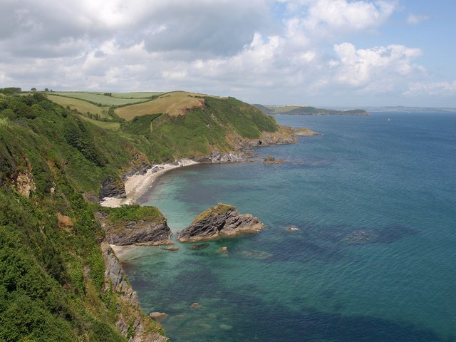
Little Polstreath. The small beach is separated from Polstreath to the north by what appears, from this angle, to be a single headland. The further, less vegetated part is a separate stack. That water does look tempting, but it is about 70 metres below.
Polstreath and Little Polstreath. The two beaches are separated by the headland and stack; Little Polstreath is the beach on this side. Beyond is Penare Point, with Black Head in the distance. Seen over a rather awkward high fence at Pentillie.


