Milton Creek Country Park
![]()
![]() A short circular cycle or walk around Milton Creek Country Park in Sittingbourne in Kent. The park is set in 128 acres and contains Milton Creek, fishing lakes and a network of well laid out paths. The heritage Sittingbourne and Kemsley Light Railway also runs though the Park. The nearby Kemsley railway station makes for a good access point for the route.
A short circular cycle or walk around Milton Creek Country Park in Sittingbourne in Kent. The park is set in 128 acres and contains Milton Creek, fishing lakes and a network of well laid out paths. The heritage Sittingbourne and Kemsley Light Railway also runs though the Park. The nearby Kemsley railway station makes for a good access point for the route.
Postcode
ME10 2DE - Please note: Postcode may be approximate for some rural locationsPlease click here for more information
Milton Creek Country Park Ordnance Survey Map  - view and print off detailed OS map
Milton Creek Country Park Open Street Map  - view and print off detailed map
Milton Creek Country Park OS Map  - Mobile GPS OS Map with Location tracking
Milton Creek Country Park Open Street Map  - Mobile GPS Map with Location tracking
Dog Walking
The park is popular with dog walkers so you will probably meet other owners on your visit.
Further Information and Other Local Ideas
The circular Sittingbourne Walk starts from the town's train station and visits the park before heading along the Saxon Shore Way and the Swale Heritage Trail to the Little Murston Nature Reserve on the River Swale.
For more walking ideas in the area see the Kent Walks page.
Cycle Routes and Walking Routes Nearby
Photos
Drain and flood bund Looking east south east towards Kemsley Marshes and Milton Creek. The houses on the right are the edge of the Church Milton development. The footpath runs along the top of the flood bund into the newly created Church Marshes Country Park (now known as Milton Creek Country Park).
Footbridge over Marsh Stream Footpath from Beauvoir Drive (unseen, otherside of embankment) leads to Playing field (just to right of photo) at end of Eadred Way. Stream and embankment footpath leads to Grovehurst Road, they are part of the Country Park, which is open land on the Swale.
New trees planted in the park. Wildlife here includes redshank, black-tailed godwit, teal and grey plover.
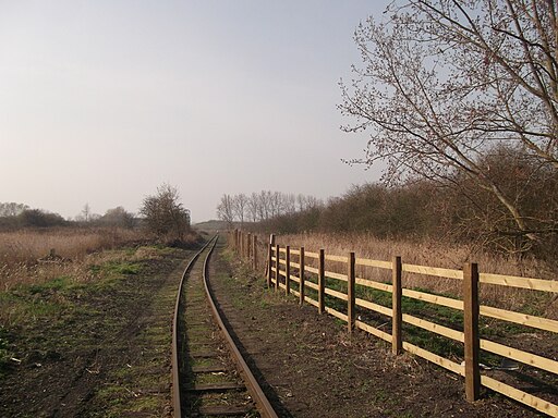
Sittingbourne and Kemsley Light Railway. The narrow gauge heritage railway operates from Sittingbourne to the banks of The Swale. The line was built in 1905 for the transportation of the raw materials required for the manufacture of paper. It continues to use the old steam engines and rolling stock as a local attraction.


