Mossley Walks
![]()
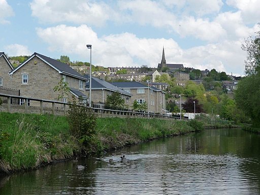
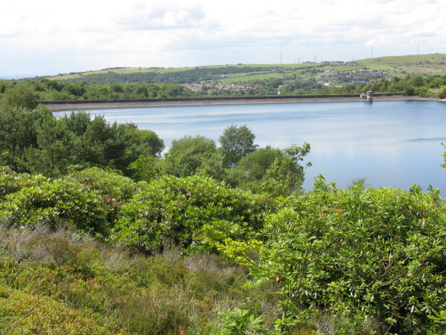
![]() This town in Greater Manchester has some fine local waterside walks along the river and canal which run through the area. There's also a number of lovely reservoirs on the surrounding Pennine Moors to visit.
This town in Greater Manchester has some fine local waterside walks along the river and canal which run through the area. There's also a number of lovely reservoirs on the surrounding Pennine Moors to visit.
This circular walk from the town visits some of the higlights of the area including the River Tame Valley Way, the Huddersfield Narrow Canal, Stalybridge Country Park, Walkerwood Reservoir, Swineshaw Reservoir and Dovestone Reservoir.
The walk starts just to the east of the train station where you can pick up the Tame Valley Way. Follow the waymarked trail south and it will take you along the river towards Millbrook where you can enjoy views of the Huddersfield Narrow Canal.
At Millbrook you head south east to visit Walkerwood Reservoir and the adjacent Stalybridge Country Park. You'll then head east past Brushes Reservoir to the two Swineshaw Reservoirs, using a section of the epic Pennine Bridleway. You can follow this waymarked cycling and walking trail north west across Slatepit Moor to Buckton Moor where you'll pass an old quarry and Buckton Castle.
The route then bends round to visit the popular Dovestone Reservoir where you have the option of heading north to visit Saddleworth Moor or climbing to Dovestone Rocks for great views over the area. This route heads back west past Greenfield before returning to Mossley.
Postcode
OL5 9HL - Please note: Postcode may be approximate for some rural locationsMossley Ordnance Survey Map  - view and print off detailed OS map
Mossley Open Street Map  - view and print off detailed map
Mossley OS Map  - Mobile GPS OS Map with Location tracking
Mossley Open Street Map  - Mobile GPS Map with Location tracking
Walks near Mossley
- Tame Valley Way - Follow the River Tame through Greater Manchester from Stockport to Denshaw on this waterside walk
- Huddersfield Narrow Canal - Follow the Huddersfield Narrow Canal from Greater Manchester into the Peak District on this easy waterside walk
- Stalybridge Country Park - This country park contains several large reservoirs and some beautiful open moorland
- Walkerwood Reservoir - This circular walk takes you around Walkerwood Reservoir in Stalybridge Country Park
- Swineshaw Reservoir - Enjoy a circular walk around the Swineshaw Reservoirs on this route on the Pennine Moors.
Start the walk from the car park at Walkerwood Reservoir on Brushes Road - Dovestone Reservoir - Enjoy an easy circular walk around this lovely reservoir on Saddleworth Moor
- Pennine Bridleway - This fabulous 120 mile long trail runs through the beautiful Derbyshire Peak District, through Lancashire and on into Yorkshire.
It is suitable for mountain bikers, horse riders and walkers taking you on a tour through some of the most beautiful parts of the country - Saddleworth Moor - Enjoy a walk across this atmospheric moor in the Peak District
- Tame Valley Way - Follow the River Tame through Greater Manchester from Stockport to Denshaw on this waterside walk
- Bottoms Reservoir - Enjoy an easy circular walk around this pretty reservoir in the Peak District
- Torside Reservoir - Enjoy a circular walk or cycle around this large man made lake in the Derbyshire Peak District
- Woodhead Reservoir - Enjoy a walk alongside this pretty reservoir in the Peak District
- Crowden - The hamlet of Crowden is a popular start point for exploring a stunning area of the Pennines
- Longdendale Trail - This splendid cycling and walking trail follows a disused railway line through the Longdendale in the Peak District National Park
- Chew Reservoir - Visit this pretty reservoir in the Peak District and enjoy great views over Saddleworth Moor on this walk near Mossley.
You can start your walk from the Dovestone Reservoir car park and follow the Oldham Way over the Chew Hills to reach the reservoir - Oldham Way - Enjoy the canals, reservoirs and countryside around Oldham on this splendid circular walk
- Greenfield Reservoir - Enjoy a waterside walk along Yeoman Hey Reservoir to Greenfield Reservoir in the Peak District National Park.
You can start the walk from the car park at the northern end of Dovestone Reservoir - Pots and Pans - Climb to a distinctive hill on this circular walk on Saddleworth Moor, Oldham
- Dovestone Rocks - This walk climbs to a series of wonderful viewpoints overlooking Dovestone Reservoir in the dark peak area of the Peak District
- Uppermill - The pretty village of Uppermill is in a lovely location on the Huddersfield Narrow Canal and the River Tame
- Ashton Canal - Enjoy a waterside walk or cycle along this 6 mile long canal in Manchester
- Middle Black Clough Waterfall Walk - This walk visits the waterfalls at Middle Black Clough and Far Black Clough near Woodhead Reservoir in the Peak District
Pubs/Cafes
The Gillery is a good choice for some post walk refreshment. The pub occupies the old banking halls on the ground level of the Old Bank in the town. There's a splendid outdoor area with great views over the surrounding area. You can find them at postcode OL5 0AD.
There's also the Roaches Lock Inn. The pub's main attraction is a lovely beer garden with fine views of the Huddersfield Narrow Canal. It's an ideal spot for a rest on a fine day. You can find it at 387 Manchester Road with postcode OL5 9BB for your sat nav.
Dog Walking
The river and moorland trails make for a fine dog walk. The Gillery mentioned above is also dog friendly.
Further Information and Other Local Ideas
To the south east there's Arnfield Reservoir. The walk here takes you along the eastern edge of the reservoir before visiting the woodland and lake in the nearby Hollingworth Nature Reserve.
For more walking ideas in the area see the Greater Manchester Walks, the South Pennines Walks and the Peak District Walks pages.


