Mundesley Walks
![]()
![]() This lovely seaside village has some nice coastal trails to follow in both directions. It is part of the Norfolk Coast AONB where there's some wonderful coastal scenery. This walk follows the England Coast Path south east to the nearby village of Bacton. The route runs for just over 2 miles on a flat path running along the beaches. As such it's suitable for all abilities.
This lovely seaside village has some nice coastal trails to follow in both directions. It is part of the Norfolk Coast AONB where there's some wonderful coastal scenery. This walk follows the England Coast Path south east to the nearby village of Bacton. The route runs for just over 2 miles on a flat path running along the beaches. As such it's suitable for all abilities.
This route uses part of the Paston Way long distance trail. To continue your walking in the area you could follow the waymarked path to the North Walsham and Dilham Canal and the Pretty Pigney's Wood Nature Reserve. You can follow the path through the countryside from Bacton, passing Knapton and the noteworthy Bacton Woods on the way. The attractive woods have 30 species of tree, including Scots and Corsian Pine, Western Hemlock, Douglas Fir and Larch. Near North Walsham you can also pick up the Weavers' Way long distance footpath.
You could also head along the England Coast Path in the other direction. This will take you to Overstrand where you can pick try the Cromer to Overstrand Walk. This takes you along a super cliff top path with great views over the area.
Mundesley Ordnance Survey Map  - view and print off detailed OS map
Mundesley Open Street Map  - view and print off detailed map
Mundesley OS Map  - Mobile GPS OS Map with Location tracking
Mundesley Open Street Map  - Mobile GPS Map with Location tracking
Further Information and Other Local Ideas
Head south west along the Paston Way from the village and you could pay a visit to the nearby Gunton Park. There's a huge deer park and a 19th century working sawmill to see at this historic site. The picturesque thatched mill is notable as the only surviving water powered sawmill in Norfolk. The walk also includes a visit to the excellent Gunton Arms pub where there are fine views over the estate.
If you head south along the coast path you could visit the worthy village of Happisburgh. There's a lovely secluded beach, a striking 18th century lighthouse and a historic 15th century church to see here. Near here there's also Sea Palling where there's a blue flag beach and sand dunes to explore.
For more walking ideas in the area see the Norfolk Walks page.
Cycle Routes and Walking Routes Nearby
Photos
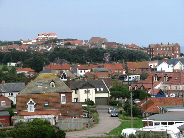
View over the village of Mundesley. The red-brick building seen in mid-distance (at right) is the Manor Hotel. In the background (centre) the church of All Saints can be seen. The building glimpsed on the horizon (at left, in adjacent grid square), located high above the village, is Trafalgar Court. When the railway opened in 1889 - bringing visitors wishing to sample the fresh sea air - the village of Mundesley grew rapidly. The railway is now long gone but Mundesley is still considered to be one of the best a holiday resorts in Norfolk, offering a sandy beach with safe swimming for children when the tide is out; the East Norfolk Coast Path/Peddars Way follows the coastline and offers splendid views across the North Sea. Properties date mainly from Victorian times and many houses are constructed from traditional Norfolk materials such as flint and brick, with thatch or pantile roofs. The village contains a small number of shops, eating places, pubs, tea rooms and possibly the smallest museum in the country, the Maritime Museum. Several holiday parks are in the vicinity of the village, the largest one being Mundesley Holiday Village, located a short distance to the southeast.
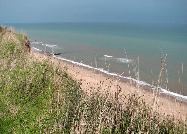
Beach below Mundesley. The building seen beyond the fishing boat hitched to a beach tractor is the Lifeboat Station. As a result of a drowning and near drowning in 1971 of a man and his wife half a mile off the beach at Mundesley, the Mundesley Parish Council called a meeting to discuss the feasibility of establishing an Inshore Lifeboat at Mundesley. It was decided to set up an independent rescue unit, funded and manned from within the village. In the spring of 1972, a Zodiac inflatable was borrowed from a local businessman and established in a temporary boathouse on the promenade at the east end of the village, followed by the purchase of a 4M Avon Sea Rider semi- rigid inflatable wholly owned by the Service. A wooden site hut was donated by a Bacton Gas Site contractor and converted into a boathouse. The boat is on call 365 days per year, 24 hours a day.
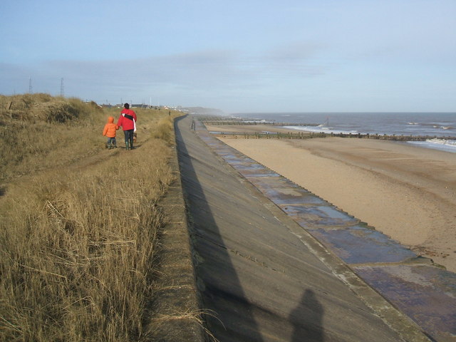
Sea wall and breakwater. A variety of sea defences have been installed along the beach to the north of Bacton. Despite all these measures the sea is regularly breaching the breakwaters, groynes, revetments and steel sheet pilings, taking away large chunks of beach and cliff face. Here the sea wall has been reinforced by a breakwater, regularly breached by high waves which take away large chunks of the soft cliff face behind


