Mynydd Illtud Common
![]()
![]() Starting at the Brecon Beacons Visitor Centre, enjoy a stroll across the pretty Mynydd Illtud Common on this easy circular walk. From the common there are great views towards Pen Y Fan and Corn Du, the Black Mountains and the river Usk. It's a good spot for wildlife too - look out for red kites, larks and butterflies.
Starting at the Brecon Beacons Visitor Centre, enjoy a stroll across the pretty Mynydd Illtud Common on this easy circular walk. From the common there are great views towards Pen Y Fan and Corn Du, the Black Mountains and the river Usk. It's a good spot for wildlife too - look out for red kites, larks and butterflies.
Postcode
LD3 8ER - Please note: Postcode may be approximate for some rural locationsMynydd Illtud Common Ordnance Survey Map  - view and print off detailed OS map
Mynydd Illtud Common Open Street Map  - view and print off detailed map
Mynydd Illtud Common OS Map  - Mobile GPS OS Map with Location tracking
Mynydd Illtud Common Open Street Map  - Mobile GPS Map with Location tracking
Explore the Area with Google Street View 
Further Information and Other Local Ideas
For more walking ideas in the area see the Brecon Beacons Walks page.
Cycle Routes and Walking Routes Nearby
Photos
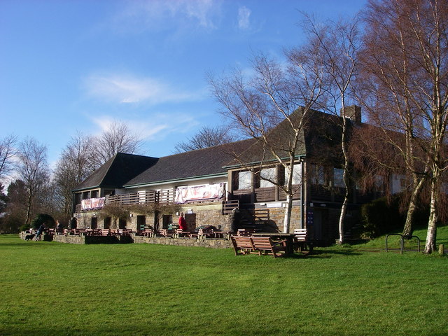
National Park Visitor Centre. This centre, often referred to as the Mountain Centre, is managed by the Brecon Beacons National Park Authority. There are a variety of exhibits on the national park including a large scale 3-D model inside. The views from the terrace across Glyn Tarell towards Pen y Fan and Corn Du are superb. A lot of visitors come to enjoy lunch or a snack in the tea-rooms downstairs.


