Needham Market Lake Walk
![]()
![]() Enjoy an easy stroll around Needham Lake on this short walk in Needham Market. After following the trail around the main lake you can pick up the Gipping Valley River Path and follow the riverside path south to Bosmere and Alderson Lake.
Enjoy an easy stroll around Needham Lake on this short walk in Needham Market. After following the trail around the main lake you can pick up the Gipping Valley River Path and follow the riverside path south to Bosmere and Alderson Lake.
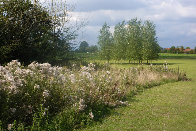
It's a very pretty area with wetland areas, meadows and a small woodland. In the summer months you can see lots of wildflowers including pyramidal and bee orchids. You should also see lots of water loving birdlife on the lake.
You can park at the car park off Coddenham Road and pick up the nice surfaced trails from here. Needham Market train station is also very close by so you can access the site from there quite easily.
To extend your walk you can follow the Gipping River south towards Ipswich and visit Suffolk Water Park.
Please scroll down for the full list of walks near and around Needham Lake. The detailed maps below also show a range of footpaths, bridleways and cycle paths in the area.
Postcode
IP6 8HB - Please note: Postcode may be approximate for some rural locationsNeedham Lake Ordnance Survey Map  - view and print off detailed OS map
Needham Lake Open Street Map  - view and print off detailed map
*New* - Walks and Cycle Routes Near Me Map - Waymarked Routes and Mountain Bike Trails>>
Needham Lake OS Map  - Mobile GPS OS Map with Location tracking
Needham Lake Open Street Map  - Mobile GPS Map with Location tracking
Explore the Area with Google Street View 
Walks near Needham Lake
- Gipping Valley River Path - Follow the River Gipping from Stowmarket to Ipswich on this pleasant riverside walk
- Helmingham Hall - This walk visits the beautiful estate surrounding the 16th century Helmingham Hall in Suffolk.
- Coddenham - This walk explores the parkland, countryside and rivers around the Suffolk village of Coddenham
- Haughley Park - The historic Haughley Park is located just west of the Suffolk village of Haughley.
Dog Walking
Needham Lake in Suffolk is a popular spot for dog walkers, offering a gentle, level walk around the lake with a large, free car park and dog-friendly facilities, including a designated off-lead area.
Further Information and Other Local Ideas
A few miles to the east you could visit the pretty village of Helmingham and explore the 16th century Helmingham Hall Estate. There's some lovely footpaths here taking you to herbaceous borders, tree lined avenues and beautiful gardens.
Also to the east is neighbouring Coddenham where there's nice walks through the old Shrubland Park and a noteworthy 16th century pub to visit.
To the north west there's Haughley Park where you can enjoy bluebell walks around the historic 17th century estate.
Photos
Needham Lake. The Local Nature Reserve that has flourished from its origins as former sand and gravel workings into a vibrant habitat supporting diverse flora and fauna. The lake and its surrounding wetlands are home to a variety of wildlife, including numerous well-fed ducks, dragonflies, and small birds. The area features aquatic, marsh, and scrub habitats, providing a sanctuary for various species
General view of the lake from near the bridge over the canal. Beyond its ecological significance, Needham Lake offers a range of amenities and activities for visitors. A surfaced pathway encircles the lake, facilitating leisurely walks and wildlife observation. The site includes picnic areas adjacent to the River Gipping and a children's play area equipped with wooden sculptures and climbing logs. Fishing and model boating are popular activities, with permits required for participation. Regular guided walks and children's activities are organized throughout the year, enhancing the lake's appeal as a family-friendly destination. Facilities such as toilets and on-site staff presence contribute to a comfortable visitor experience.
Pond in Needham Market. A winter view. The pond is at the junction of Barrett's Lane and Hurstlea Road, and is home to a large number of ducks. Needham Market, the town encompassing Needham Lake, boasts a rich history and a variety of attractions. Notable buildings include the 15th-century Church of St. John the Baptist, renowned for its distinctive double-hammerbeam roof, and the medieval Limes Hotel, dating back to around 1500. The town's Old Town Hall, designed by architect Frederick Barnes and completed in 1866, adds to its architectural heritage. Historically, Needham Market was a hamlet of Barking and did not become a separate parish until the early 20th century. The town's name, first recorded in 1245, has evolved from earlier spellings such as 'Nedeham' and 'Nedham.' Modern street names like Chainhouse Road and The Causeway reflect historical events, including associations with the plague. Today, Needham Market offers a blend of historical charm and modern amenities, making it a noteworthy destination in Suffolk.
Hawk's Mill. This mill, which sits astride the River Gipping, was built in 1884. It has been converted recently into flats. The water from the River Gipping flows through the two arches below the converted mill.


