Newport Canal Walk
![]()
![]() Enjoy an easy stroll along the towpath of the Monmouthshire and Brecon Canal from Newport to the Fourteen Locks Canal centre.
Enjoy an easy stroll along the towpath of the Monmouthshire and Brecon Canal from Newport to the Fourteen Locks Canal centre.
The walk starts at the beginning of the canal at Barrack Hill. The route then heads west through Allt-yr-yn, passing Alteryn Wood on the way. You then pass the motorway before coming to the Fourteen Locks. Also known as the Cefn Flight the locks were completed in 1799 and raise the water level 160 ft (50 m) in just 800 yd (740 m).
The visitor centre is located next to the pound below the top lock and includes exhibits about the canal, changing displays of local art, a meeting room and a tea room for refreshments. Guided walks along the canal are also offered by the centre.
Near here you can look out for a variety of wildlife including otters, coots, moorhens, swans, herons and grey wagtails. There's also a high tec information point which lets visitors experience a 'virtual' journey along the canal and learn how the canal locks work.
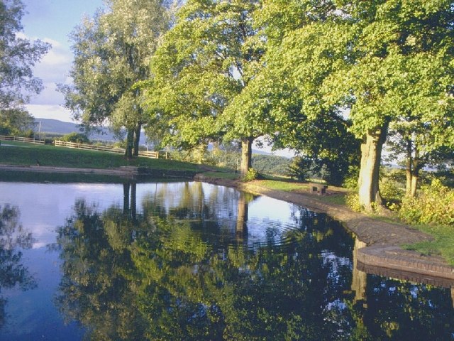
The centre is located very close to the pretty Ynysyfro Reservoirs. The two small lakes are very picturesque and can be reached from a footpath just to the west of the Fourteen Locks. You could also extend the walk by continuing along the canal to nearby Risca. Here you could pay a visit to the splendid Sirhowy Valley Country Park where there's 1000 acres of woodland and meadows to explore.
Newport Canal Walk Ordnance Survey Map  - view and print off detailed OS map
Newport Canal Walk Open Street Map  - view and print off detailed map
Newport Canal Walk OS Map  - Mobile GPS OS Map with Location tracking
Newport Canal Walk Open Street Map  - Mobile GPS Map with Location tracking
Further Information and Other Local Ideas
For more nice waterside walking head to the nearby Newport Wetlands nature reserve where there's lots of nice trails and wildlife spotting opportunites. In this area you can also pick up the Redwick Circular Walk and visit the Newport Seawall at Goldcliff on the Severn Estuary. The village of Redwick also includes a notable medieval church which is Grade I listed.
You could also head to the neighbouring town of Caerleon and try the Caerleon Walk. This takes you to the fascinating Roman Fortress, Chepstow Hill and Wentwood Forest. This expansive forest is just a few miles north east of Newport and includes the pretty Wentwood Reservoir.


