Norsey Woods
![]()
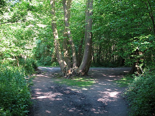
![]() These lovely woods near Billericay have some good waymarked footpaths to try. The site covers 165 acres with ancient coppiced sweet chestnut, oak and hornbeam woodland. It is also a local nature reserve with ponds, streams and lots of bluebells in the spring months. There's also a heather glade, bluebells in the spring and lots of wildflowers in the summer months. Look out for wildlife including dormouse, pipistrelle bat and newts around the ponds. The area is a well managed with a car park, visitor centre, toilets and picnic centre.
These lovely woods near Billericay have some good waymarked footpaths to try. The site covers 165 acres with ancient coppiced sweet chestnut, oak and hornbeam woodland. It is also a local nature reserve with ponds, streams and lots of bluebells in the spring months. There's also a heather glade, bluebells in the spring and lots of wildflowers in the summer months. Look out for wildlife including dormouse, pipistrelle bat and newts around the ponds. The area is a well managed with a car park, visitor centre, toilets and picnic centre.
To continue your walking in the Billericay area you can head about 2 miles to the north east and visit Hanningfield Reservoir. The southern end of the water has some good woodland trails with nice views over the water.
Postcode
CM11 1HA - Please note: Postcode may be approximate for some rural locationsNorsey Woods Ordnance Survey Map  - view and print off detailed OS map
Norsey Woods Open Street Map  - view and print off detailed map
Norsey Woods OS Map  - Mobile GPS OS Map with Location tracking
Norsey Woods Open Street Map  - Mobile GPS Map with Location tracking
Dog Walking
The woods are a lovely place for a dog walk and you will probably see several other owners on your outing.
Further Information and Other Local Ideas
Near the town you can visit the splendid Imperial Bird of Prey Academy. It's the leading Bird of Prey Centre in Essex, based at Barleylands Farm & Craft Village and one of the real highlights of the area. You can handle the birds and spend some time flying an owl. There's also a wonderful flying display, a reptile house and informative talks to enjoy. You can find it in Billericay at a postcode of CM11 2UD for your sat navs.
The Billericay Walk starts in the lovely Park Meadows in the town centre. It visits the woods before heading to nearby Hanningfield Reservoir.
Just to the north is the pretty village of Ingatestone where you can enjoy views of the River Wid and visit the 16th century Ingatestone Hall.
For more walking ideas in the area see the Essex Walks page.
Cycle Routes and Walking Routes Nearby
Photos
Woods during the winter. This view is seen as you leave the wood by car to join Outwood Common Road.


