Pen Cerrig Calch Walk
![]()
![]() This walk climbs to Pen Cerrig Calch from the town of Crickhowell in the Black Mountains area of the Brecon Beacons National Park.
This walk climbs to Pen Cerrig Calch from the town of Crickhowell in the Black Mountains area of the Brecon Beacons National Park.
The hill is a subsidiary summit of Waun Fach which lies a few miles to the north.
The walk follows a section of the long distance Cambrian Way from the pretty riverside town to the summit.
Start the walk in Crickhowell and follow the waymarked trail north east towards Table Mountain. Here you will find some interesting geology and the fortification of Crug Hywel, a presumed Iron Age hillfort.
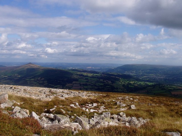
You continue north to the Pen Cerrig Calch summit which stands at a height of 701 metres. From here you can enjoy some wonderful views over the surrounding mountains of the Brecon Beacons including Sugar Loaf and Blorenge. There's also more interesting geology with limestone rock formations to see.
Pen Cerrig Calch Ordnance Survey Map  - view and print off detailed OS map
Pen Cerrig Calch Open Street Map  - view and print off detailed map
Pen Cerrig Calch OS Map  - Mobile GPS OS Map with Location tracking
Pen Cerrig Calch Open Street Map  - Mobile GPS Map with Location tracking
Cycle Routes and Walking Routes Nearby
Photos
From Trwyn Ysgwrfa towards Crug Hywel. The path descending Pen Cerrig-calch drops away at this point as the tough quartzite which forms much of the upper part of the hill gives way to the softer 'Brownstones' - sandstones and mudstones. There is evidence of quarrying having taken place here in the past.
Some of the "cerrig calch" (lime stone) that gives Pen Cerrig Calch its name. The whole top is scattered in lumps of this bright white rock of all sizes. Pen Cerrig Calch is the southern end of the western Black Mountains ridge. Sugar Loaf and Blorenge are in the background. The summit and the ridge linking it with Pen Allt Mawr pretty much fills this square. The vegetation is scrubby grassland interspersed with those rocks. It's a lot drier ground than most of the Black Mountains.


