Pooley Bridge to Glenridding Walk
![]()
![]() This fine, lakeside walk takes you from one end of Ullswater to the other. It's about a 10 mile walk, taking in some of the best scenery of the Lake District. Along the way you'll pass peaceful woods, rushing waterfalls, pretty becks and spectacular mountains. The walk is generally fairly easy going but there are some small climbs along the way.
This fine, lakeside walk takes you from one end of Ullswater to the other. It's about a 10 mile walk, taking in some of the best scenery of the Lake District. Along the way you'll pass peaceful woods, rushing waterfalls, pretty becks and spectacular mountains. The walk is generally fairly easy going but there are some small climbs along the way.
The walk starts from the village of Pooley Bridge, located at the north eastern end of the lake. The first section heads south along the lake to Sharrow Bay, passing underneath Barton Fell on the way. At Sharrow Bay you can visit the country house, enjoy refreshments and explore the beautiful formal gardens.
The route continues to Howton where you can catch the famous 'Ullswater Steamers' which will take you across the lake. At the little hamlet there is also the option of climbing Hallin Fell for wonderful views across the water to the surrounding fells.
The route continues through Hallinhag Wood and Sandwick, crossing the Boredale Beck as you go. You then pass the Scalehow Waterfall before coming to Birk Fell and Silver Bay.
You continue south to the village of Patterdale, passing the Devil's Chimney and Blowick Bay on the way. This section passes under Patterdale Common and Place Fell, which is another great viewpoint.
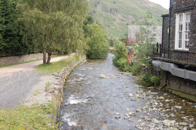
The final section takes you through Patterdale, crossing the Grisedale Bridge over the Grisedale Beck before heading past the woodland under Raven Crag and finishing at Glenridding.
You can extend the walk by continuing round the lake to the popular Aira Force. The lovely waterfall is surrounded by attractive woodland with great views to be found in the adjacent Gowbarrow Park.
Pooley Bridge to Glenridding Ordnance Survey Map  - view and print off detailed OS map
Pooley Bridge to Glenridding Open Street Map  - view and print off detailed map
Pooley Bridge to Glenridding OS Map  - Mobile GPS OS Map with Location tracking
Pooley Bridge to Glenridding Open Street Map  - Mobile GPS Map with Location tracking
Further Information and Other Local Ideas
Just to the south east of Pooley Bridge you can enjoy a climb to Askham Fell and enjoy great views down to the lake and across to the surrounding fells. Askham Hall with its stunning gardens and interesting history is also nearby.
The Pooley Bridge to Aira Force Walk will take you to the popular National Trust waterfall via Swinburn's Park and Gowbarrow Park.
The climb to Bonscale Pike and Arthur's Pike starts at Howtown. They are both fine Ullswater viewpoints with the photogenic Bonscale Tower a highlight on the walk. You can take a small detour from the route at Howton to climb to the fells as an optional walk extension.


