Poolsbrook Country Park
![]()
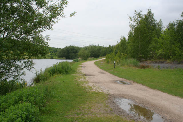
![]() This 180 acre park consists of 85 acres of woodland, 42 acres of grassland and 23 acres of green water. There are several miles of well maintained paths suitable for cyclists or walkers. The park is located in Staveley, very near to Chesterfield and the village of Duckmanton.
This 180 acre park consists of 85 acres of woodland, 42 acres of grassland and 23 acres of green water. There are several miles of well maintained paths suitable for cyclists or walkers. The park is located in Staveley, very near to Chesterfield and the village of Duckmanton.
To extend your walk you can head north from the park and link up with the Chesterfield Canal. You could then follow a nice section of the canal into Chesterfield.
The Cuckoo Way long distance trail also runs to the north of the park. Follow it north and you will come to Eckington's Renishaw Hall and Rother Valley Country Park.
Postcode
S43 3LS - Please note: Postcode may be approximate for some rural locationsPoolsbrook Country Park Ordnance Survey Map  - view and print off detailed OS map
Poolsbrook Country Park Open Street Map  - view and print off detailed map
Poolsbrook Country Park OS Map  - Mobile GPS OS Map with Location tracking
Poolsbrook Country Park Open Street Map  - Mobile GPS Map with Location tracking
Pubs/Cafes
There's a good on site cafe where you can enjoy a range of meals and snacks after your exercise.
Dog Walking
The park is ideal for a dog walk so expect to see plenty of other owners on a fine day.
Further Information and Other Local Ideas
For more walking ideas in the area see the Derbyshire Walks page.
Cycle Routes and Walking Routes Nearby
Photos
Residential street in Poolsbrook village. The village was established by the Staveley Coal and Iron Company towards the end of the 19th century. It was built to provide housing for workers employed at the nearby Speedwell and Ireland Collieries. Over time, as the need for more housing arose, new houses were constructed, which the locals refer to as the "new village." The original houses, which were part of the initial construction, have since been demolished.
This pattern of development is typical of many industrial villages in the UK, where housing was often provided by the company to ensure that workers lived close to their place of employment. The shift from old to new housing reflects changes in the needs and standards of living over the years.


