Porth Iago Walk
![]()
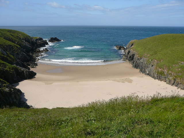
![]() This walk explores the area around Porth Iago on the Llyn Peninsula.
This walk explores the area around Porth Iago on the Llyn Peninsula.
It's a lovely place for a stroll with a beautiful sandy cove, an ancient hill fort, low grassy headlands and a nice cliff top path. Starting from the public car park at the site you can follow a section of the Llyn Coastal Path east to Porth Ferin where there's another secluded bay with clear blue waters. The beach below is reachable by scrambling down the dunes.
To continue your walk head south along the coast path to Whistling Sands where there's another lovely beach. A little further on there's Aberdaron where you can climb to an excellent viewpoint at Mynydd Mawr.
Heading north will take you towards Llangwnnadl and the beach at Penllech.
Postcode
LL53 8LP - Please note: Postcode may be approximate for some rural locationsPorth Iago Ordnance Survey Map  - view and print off detailed OS map
Porth Iago Open Street Map  - view and print off detailed map
Porth Iago OS Map  - Mobile GPS OS Map with Location tracking
Porth Iago Open Street Map  - Mobile GPS Map with Location tracking
Pubs/Cafes
Caffi Porthor is located close to the car park and sells a good range of meals and snacks. There's outdoor seating with fine views as well. They are dog friendly.
Further Information and Other Local Ideas
For more walking ideas in the area see the Llyn Peninsula Walks page.


