Pulpit Hill and Whiteleaf Hill Circular Walk
![]()
![]() This circular walk from Princes Risborough makes use of a section of a The Ridgeway to visit Pulpit Hill and Whiteleaf Hill. The route runs for a distance of about 6 miles, with some moderate climbs and the reward of splendid views over the surrounding Chilterns countryside.
This circular walk from Princes Risborough makes use of a section of a The Ridgeway to visit Pulpit Hill and Whiteleaf Hill. The route runs for a distance of about 6 miles, with some moderate climbs and the reward of splendid views over the surrounding Chilterns countryside.
Starting from the Whiteleaf Hill car park you follow the waymarked footpath a short distance to the north to visit Whiteleaf Hill. The hill is also a nature reserve with five scheduled ancient monuments, including some dating to the Neolithic and Bronze Ages and the Whiteleaf Cross, a chalk carving thought to date to the eighteenth century. The area also includes semi-natural beech woodland which dates back to at least 1600. Look out for wildlife including whitethroat birds, and butterflies such as the speckled wood and the peacock.
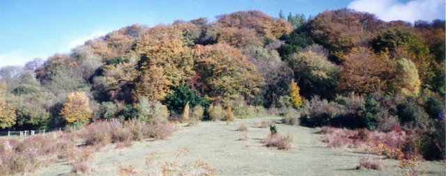
The route continues north to Grangelands and Pulpit Hill, a biological Site of Special Scientific Interest in Cadsden. Pulpit Hill is run by the National Trust and includes grassland and scrub, which support interesting breeding birds and invertebrates, such as glow-worms and marbled whiteand chalk hill blue butterflies. There are also areas of mature beech woodland, with a sparse shrub layer of holly and elder.
After exploring the site the walk continues east along the Ridgeway to Buckmoorend. This noteworthy section passes Chequers, the country house retreat of the Prime Minister. At Buckmoorend you pick up the Icknield Way Path. This takes you south through Chisley Wood to Little Hampden Common. Here you turn west to follow a footpath to Dirtywood Farm and Ninn Wood before returning to the car park.
You can extend the walk by continuing along the Ridgeway north to visit Coombe Hill. The popular hill is the highest viewpoint in the Chiltern Hills and commands wonderful views over Aylesbury Vale and the Cotswolds.


