Ravenscar to Robin Hood's Bay Circular Walk
![]()
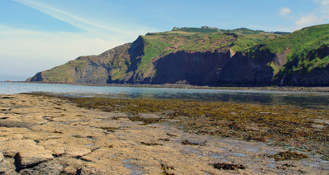
![]() This circular walk explores some of the finest coast and countryside of the North York Moors National Park. The route runs for a distance of just under 11 miles, taking you inland through some beautiful moorland scenery before returning along the stunning North Yorkshire coastline. It's an undulating walk with some moderate climbs and fine views from the high points.
This circular walk explores some of the finest coast and countryside of the North York Moors National Park. The route runs for a distance of just under 11 miles, taking you inland through some beautiful moorland scenery before returning along the stunning North Yorkshire coastline. It's an undulating walk with some moderate climbs and fine views from the high points.
The walk starts from the Ravenscar Visitor Centre where there's a good sized car park. From here you pick up footpaths heading west onto Stony Marl Moor. You'll pass Cook House, Spring Hill, and Thorny Brow before a woodland section through Allison Head Wood.
The next section crosses Mill Beck before passing through Fylingthorpe and reaching the coast at Robin Hood's Bay. The picturesque little village is one of the jewels of the Yorkshire coast with lots of delightful old fishermen's cottages and a lovely beach. The popular tourist village has a number of good pubs and cafes for refreshments before the final leg of the walk.
After exploring the village the route picks up a section of the Cleveland Way. The waymarked path heads south to Boggle Hole.
The area is named after the local name for a hobgoblin, a mischievous 'little person' thought to dwell in the caves along the coast. Smugglers used the local caves to conceal their contraband including rum and tobacco. The beach is a popular place for fossil hunters so keep your eyes peeled as you make your way through the area.
The final section takes you past Stoupe Beck Sands and Peter White Cliff before returning to the car park in Ravenscar.
To extend your walking in the area try the longer Whitby to Scarborough Walk which visits Whitby Abbey, Robin Hood's Bay and Scarborough Castle.
Postcode
YO13 0NE - Please note: Postcode may be approximate for some rural locationsRavenscar to Robin Hoods Bay Circular Walk Ordnance Survey Map  - view and print off detailed OS map
Ravenscar to Robin Hoods Bay Circular Walk Open Street Map  - view and print off detailed map
Ravenscar to Robin Hoods Bay Circular Walk OS Map  - Mobile GPS OS Map with Location tracking
Ravenscar to Robin Hoods Bay Circular Walk Open Street Map  - Mobile GPS Map with Location tracking
Further Information and Other Local Ideas
The epic Lyke Wake Walk starts/finishes in the village. You pick up this challenging trail and follow it west to explore Fylingdales Moor. Here you can enjoy climbs to Simon Howe and Two Howes Rigg where there are splendid views over the area.


