Ribblehead Viaduct Walk
![]()
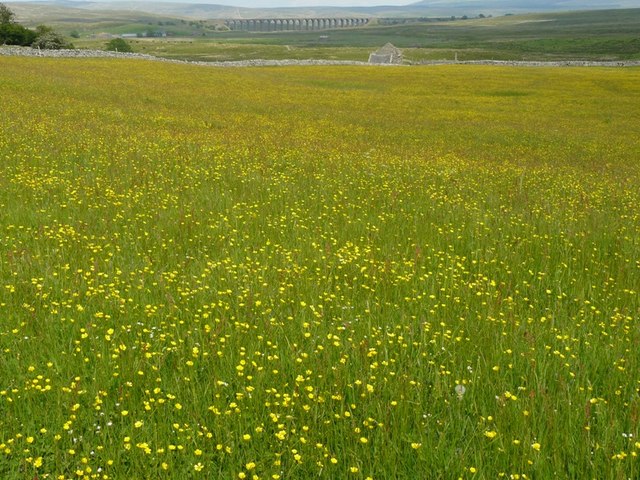
![]() Enjoy a circular walk around this famous landmark in the Yorkshire Dales. The impressive viaduct carries the Settle-Carlisle Railway across Batty Moss in the valley of the River Ribble at Ribblehead, in North Yorkshire. The Grade II* listed structure is one of England's greatest monuments to Victorian engineering. It is a hugely pictureque spot with the structure surrounded by imposing Yorkshire Hills.
Enjoy a circular walk around this famous landmark in the Yorkshire Dales. The impressive viaduct carries the Settle-Carlisle Railway across Batty Moss in the valley of the River Ribble at Ribblehead, in North Yorkshire. The Grade II* listed structure is one of England's greatest monuments to Victorian engineering. It is a hugely pictureque spot with the structure surrounded by imposing Yorkshire Hills.
You can start the walk from the car park just to the south of the viaduct, off the B6255. You can also visit the viaduct by public transport by catching the train to Ribblehead railway station. It's an interesting little station with a small shop selling memorabilia and a Visitor Centre which includes exhibits about the history of the line and the fight to keep it open.
From the car park footpaths head north on the eastern side of the railway line, taking you to Winterscales Farm. Here you turn south west towards Broadrake, before crossing Winterscale Beck and heading back towards the viaduct.
After your walk you can enjoy refreshments at the excellent Station Inn. The classic stone pub overlooks the viaduct and has free parking.
You can follow the path to the viaduct by using the google street view link below. It shows the surfaced path with views of the viaduct and hills behind.
To extend your walking in the area you could continue west and visit Twistleton Scar where there is some splendid limestone scenery.
The challenging climb to Whernside can also be started from the same car park. One of the Yorkshire Three Peaks, the mountain stands at a height of 736 m (2,415 ft) with tremendous views towards the Lake District and the coast. Our Whernside, Ingleborough Circular Walk starts and finishes from the viaduct and will take you up to Park Fell and Simon Fell before visiting two of the famous peaks.
The long distance Dales Way and Ribble Way both pass near to the viaduct so you could pick up these splendid trails to further explore this area of the Yorkshire Dales National Park.
Postcode
LA6 3AS - Please note: Postcode may be approximate for some rural locationsRibblehead Viaduct Ordnance Survey Map  - view and print off detailed OS map
Ribblehead Viaduct Open Street Map  - view and print off detailed map
Ribblehead Viaduct OS Map  - Mobile GPS OS Map with Location tracking
Ribblehead Viaduct Open Street Map  - Mobile GPS Map with Location tracking
Explore the Area with Google Street View 
Pubs/Cafes
After your exercise treat yourself to well earned refreshments at the Station Inn (Postcode: LA6 3AS). The pub is located next to the Ribblehead Viaduct and is very walker friendly. There's a good menu and you can also book rooms for the night. Just up the road to the west you'll find the Old Hill Inn (LA6 3AR). This pub dates all the way back to 1615 and is another popular spot for walkers exploring the Dales.
Further Information and Other Local Ideas
To continue your walking along the Settle-Carlisle Railway catch the train to the worthy village of Armathwaite. The village includes nice walks along the River Eden, some peaceful local woodland and two fine old pubs. Near here you'll also find Lacys Caves and Long Meg, two interesting historical sites next to the line.
Also on the line is Dent station where you can visit Dent Head Viaduct and Arten Gill Viaduct. There's some fine hill climbs and more riverside trails to enjoy in this scenic area.
Cycle Routes and Walking Routes Nearby
Photos
Ribblehead Station. Looking down on the Station from the summit of the road from Ingleton. The Station doubles as a visitor centre for the Settle and Carlisle Railway.
Crossing the viaduct. Empty coal wagons being hauled across Ribblehead Viaduct by a class 66 locomotive (No 66051). Both locomotive and stock are in the now defunct EWS livery. EWS (English, Welsh and Scottish Railway) was an American and then Canadian consortium which purchased most of the British Rail freight operations when privatised in 1996. In 2007, EWS was purchased by DB Schenker Rail (UK), a wholy owned subsidiary of German State Railways. It is intended that the EWS livery will be replaced by that of DB Schenker Rail in due course. This view was taken from the Ribblehead Station Inn. The lower slopes of Whernside are visible beyond.
From Ivescar. The structure carries the Settle–Carlisle railway across Batty Moss. Construction began in late 1869 by the Midland Railway. It required a large workforce, of up to 2,300 men, most of whom lived in shanty towns set up near its base. It was a dangerous job as 100 men lost their lives during its construction. The line is notable as the last main railway in Britain to be constructed primarily with manual labour. It opened to passengers in 1876.


