Roadford Lake
![]()
![]() This beautiful 730 acre lake and country park in Dartmoor is perfect for a waterside cycle or walk. The route starts at the car park by the lakeside cafe and then takes you around the lake on quiet country lanes.
This beautiful 730 acre lake and country park in Dartmoor is perfect for a waterside cycle or walk. The route starts at the car park by the lakeside cafe and then takes you around the lake on quiet country lanes.
There are also two way-marked cycle trails starting near the cafe/visitor centre. The green trail is an easy ride through the woodland and as ideal for families. The blue trail is more adventurous and will suit anyone looking for a fun off road trail.
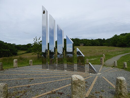
For walkers there are 5 way-marked trails taking you to the cob shelter, bird hide and Jubilee Sundial. Look out for a wide variety of wildlife in the woodland and on the lake.
Postcode
PL16 0JL - Please note: Postcode may be approximate for some rural locationsRoadford Lake Ordnance Survey Map  - view and print off detailed OS map
Roadford Lake Open Street Map  - view and print off detailed map
Roadford Lake OS Map  - Mobile GPS OS Map with Location tracking
Roadford Lake Open Street Map  - Mobile GPS Map with Location tracking
Pubs/Cafes
At the southern end of the lake there's an on site cafe selling light lunches, drinks, cakes and ice creams. You can sit outside an enjoy a fine view over the lake with your refreshment. There is also a gift shop offering a variety of gifts, local produce, home and garden ware.
Dog Walking
The lake is a fine place for a dog walk though you are asked to keep them on leads due to the wildlife. There is an enclosed dog exercise area in the main car park where dogs can run around off-lead though.
Further Information and Other Local Ideas
The Two Castles Trail can be picked up a couple of miles south of the lake. This waymarked trail is a great way of exploring the countryside around Launceston and Lydford.
Head north and there's lots of trails to follow around Cookworthy Forest near Holsworthy. Just beyond the town there's more waterside walking around the lovely Tamar Lakes.
Cycle Routes and Walking Routes Nearby
Photos
Car park, Roadford Reservoir. Picnic tables at the oval-shaped car park on the east side of the lake, which can be glimpsed on the right.
Roadford Reservoir from bird hide. A view down the lake from the bird hide near Southweek. The low level of water is emphasised by the fact that the promontory on the right should be a small island. On the far side, beyond the Toft peninsula, are fields at Grinacombe.
Roadford Lake Watersports Centre. Before the lake was created in 1990 this was Lower Goodacre Farm. It is now run by South West Lakes Trust as a watersports centre. You can try out activities such as kayaking, canoeing and paddleboarding here.


