Rothley Walks
![]()
![]() This village in Leicestershire is located in the National Forest area of the country. There's canalside paths, river trails, country parks and several nearby reservoirs to visit in the surrounding area. Rothley is one of Leicestershire's most affluent areas based on number of houses worth more than £1 million.
This village in Leicestershire is located in the National Forest area of the country. There's canalside paths, river trails, country parks and several nearby reservoirs to visit in the surrounding area. Rothley is one of Leicestershire's most affluent areas based on number of houses worth more than £1 million.
This walk takes you along the nearby Grand Union Canal Walk to visit Watermead Country Park.
The walk starts at Rothley Park on the western side of the village. You then head east past the Town Green, crossing the Rothley Brook as you go. At the eastern side of the village you will come to Cossington Old Mill next to the River Soar and the canal. Here you can pick up the canal towpath and follow it south to visit Watermead Country Park. There's a number of lovely lakeside and riverside trails to follow around the park.
Rothley Ordnance Survey Map  - view and print off detailed OS map
Rothley Open Street Map  - view and print off detailed map
Rothley OS Map  - Mobile GPS OS Map with Location tracking
Rothley Open Street Map  - Mobile GPS Map with Location tracking
Walks near Rothley
- Watermead Country Park - This beautiful country park contains over 12 lakes and ponds, wildflower meadows, woodland, grassland and reedbeds set in 350 acres of parkland
- Bradgate Country Park - Bradgate is a very large, 830 acre park located just outside the city of Leicester
- Charnwood Forest - This long circular walk explores the parks, woodland, hills, nature reserves and countryside in the attractive Charnwood Forest area of Leicestershire
- Swithland Reservoir - This pretty reservoir is located just to the south east of Loughborough
- Beacon Hill Country Park - Explore 335 acres of mixed woodland, grassland, wildflower meadows and farmland on this country park walk or cycle near Loughborough
- Woodhouse Eaves - This attractive Leicestershire village has several local country parks and two nearby reservoirs for walkers to explore.
- Cropston Reservoir - Enjoy a waterside walk along this pretty reservoir in the Charnwood Forest area of Leicestershire
- National Forest Way - This splendid 75 mile walk runs from the National Memorial Arboretum in Staffordshire to Beacon Hill Country Park in Leicestershire.
- Swithland Woods - These woods in the Charnwood Forest have a series of good footpaths to try
- Tickhill - This short circular walk explores Tickhill Castle and the Mill dam walkway in the pretty little Yorkshire village.
- Loughborough Canal Walk - A waterside walk from Loughborough to Leicester along a section of the Grand Union Canal and the River Soar
- River Soar - This lovely circular waterside walk takes you along both sides of the River Soar in the city centre of Leicester
- Mountsorrel - This Leicestershire based village is in a great location for walkers wishing to explore the National Forest area of the county
Further Information and Other Local Ideas
Just to the north of the village there's the Mountsorrel and Rothley Community Heritage Centre. Here you'll find a garden railway, an interesting train museum and some pleasant nature trails. There's also Granite’s Coffee Shop where you can enjoy a bite to eat. It's a lovely place to visit if you have time after your walk. On selected weekends throughout the year you can also see the Great Central Railway heritage trains running along the line. You can find the centre at 240 Swithland Lane with postcode LE7 7UE for your sat navs.
Photos
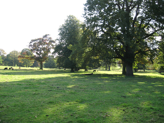
Rothley Park. Historic parkland to the east of the Rothley Court Hotel, taken from the garden boundary of the Hotel


