Roundway Hill
![]()
![]() Visit this historically significant hill on this interesting walk in Devizes. The hill is the site of a famous Civil War battle where a Royalist cavalry force under Lord Wilmot won a crushing victory over the Parliamentarians in 1643. You'll also visit the iron age hillfort of Oliver's Castle and enjoy views of the Devizes White Horse and the surrounding Wiltshire countryside.
Visit this historically significant hill on this interesting walk in Devizes. The hill is the site of a famous Civil War battle where a Royalist cavalry force under Lord Wilmot won a crushing victory over the Parliamentarians in 1643. You'll also visit the iron age hillfort of Oliver's Castle and enjoy views of the Devizes White Horse and the surrounding Wiltshire countryside.
The walk starts from the Roundway Hill car park next to Oliver's Castle. You could also easily walk to the site from Devizes by following the Wessex Ridgeway north for about two miles. You can then follow a circular route around the site for about 4 miles. There's also the option of exploring the woodland of the Roundway Hill Covert with its 68 acres of broadleaf woodland.
This route is designed for walkers but the area is also good for mountain biking with trails running across Roundway Hill and the adjacent Beacon Hill.
To extend your walk you can continue along the Wessex Ridgeway towards Morgan's Hill where you can pick up the Wansdyke Path. It's located about two miles north east of the car park at the start of this walk.
You could also visit the nearby Cherhill White Horse which is also located near Morgan's Hill.
Postcode
SN10 2JD - Please note: Postcode may be approximate for some rural locationsRoundway Hill Ordnance Survey Map  - view and print off detailed OS map
Roundway Hill Open Street Map  - view and print off detailed map
Roundway Hill OS Map  - Mobile GPS OS Map with Location tracking
Roundway Hill Open Street Map  - Mobile GPS Map with Location tracking
Pubs/Cafes
The Hourglass is in a lovely location right next to the canal in Devizes. From the terrace garden there are lovely views over the water to the surrounding countryside. It's a great place to relax and watch the boats go by on warm summer days. They have an excellent menu and can be found at Horton Avenue with a postcode of SN10 2RH.
Further Information and Other Local Ideas
For an easier walk head south into Devizes where you can try the Devizes and Caen Hill Locks Walk along the towpath of the Kennet and Avon Canal.
For more walking ideas in the area see the Wiltshire Walks and the North Wessex Downs Walks pages.
Cycle Routes and Walking Routes Nearby
Photos
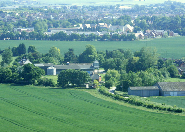
The view south from the hill. Looking down on Roundway Hill Farm. The north east part of Devizes is beyond, straggling along the A361. The crop in the foreground field is probably wheat.
Looking east from the hill. Along the northern slopes of the Vale of Pewsey, which is to our right. Easton Hill, SU0564 Kitchen Barrow Hill, SU0664 Tan Hill SU0964 and Clifford's Hill SU0863 are there with Milk Hill behind.
Looking due east towards Bishops Cannings village and church. The bottom of Clifford's Hill is in the background.


