Rushcliffe Country Park
![]()
![]() Explore over 200 acres of cycling and walking trails in this popular country park in Ruddington near Nottingham. In the park you will find wildflower meadows, grassland, conservation and landscaped areas. There is also a 2 hectare lake where you can see mute swans, great crested grebes and various duck species. Also look out for skylarks, finches, cuckoos, kestrels, sparrow hawks, reed buntings, reed warblers and sedge warblers.
Explore over 200 acres of cycling and walking trails in this popular country park in Ruddington near Nottingham. In the park you will find wildflower meadows, grassland, conservation and landscaped areas. There is also a 2 hectare lake where you can see mute swans, great crested grebes and various duck species. Also look out for skylarks, finches, cuckoos, kestrels, sparrow hawks, reed buntings, reed warblers and sedge warblers.
Postcode
NG11 6JS - Please note: Postcode may be approximate for some rural locationsPlease click here for more information
Rushcliffe Country Park Ordnance Survey Map  - view and print off detailed OS map
Rushcliffe Country Park Open Street Map  - view and print off detailed map
Rushcliffe Country Park OS Map  - Mobile GPS OS Map with Location tracking
Rushcliffe Country Park Open Street Map  - Mobile GPS Map with Location tracking
Pubs/Cafes
There's a decent on site cafe selling a good range of meals and snacks.
Dog Walking
The park is a great for dog walking and includes a Dog Agility Area. It's a fenced area with various obstacles and activities to entertain your dog.
Further Information and Other Local Ideas
Just to the south of the park you could pay a visit to the interesting villages of East and West Leake. Here you could pick up the circular East Leake Walk and explore the countryside and woodland surrounding the villages. East Leake also has a noteworthy 11th century church and the lovely Manor Farm set in 25 acres of woodland and parkland. It's one of the highlights of the area with a variety of animal breeds including donkeys, rabbits, guinea pigs, rats, lizards, snakes, parrots and axolotls.
Head north into the city and you can enjoy some lovely waterside trails on the Nottingham Canal Walk, the Nottingham Circular Walk and the Beeston Canal Walk.
For more walking ideas in the area see the Nottinghamshire Walks page.
Cycle Routes and Walking Routes Nearby
Photos
Rail Heritage Centre within the park. This picture is taken from a footbridge over the line, the heritage centre has trains from several eras in varying states of repair.
Lake view. The most numerous inhabitants are the Black-headed gulls, but probably the most interesting birds in this view were a pair of courting Shoveler, which can just be distinguished in the higher resolution version.
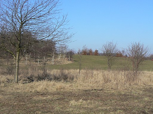
Fowemer Hill. There was always a slight hill here, which in the period before the war provided a gentle slope for downhill take-offs by a local aviation enthusiast. It was significantly raised in height as part of the development of the Country Park.
Golden trees in a brown autumn meadow. These immature laburnum trees are growing in the wildflower meadow in the country park. This picture is taken from approximately SK 567 320 looking North, the low hill in the background is the highest point in the park's rolling open countryside. The footpaths around the park are popular at lunch time with the workers from the nearby business park.


