Sandstone Trail
![]()
![]() This is a popular walk that runs through Cheshire and Shropshire from Frodsham to Whitchurch.
This is a popular walk that runs through Cheshire and Shropshire from Frodsham to Whitchurch.
The path starts in Frodsham and heads south to Frodsham Hill with lovely views over the Cheshire Plain and the Mersey Estuary. You continue to Delamere Forest with its 2,400 acres of mixed deciduous and evergreen woodland and Blakemere Moss, a lake around 1 km in length.
From Delamere you continue south towards Beeston Castle in Tarporley. With an exhibition detailing 4000 years of the castle's history and 40 acres of woodland trails, Beeston is a major attraction on the walk. Soon after you will come to Peckforton Castle, which is actually a country house built in the style of a medieval castle. It is now used as a luxury hotel.
The path then heads through the lovely Peckforton Hills, passing the Bickerton Hills and Hampton Green before joining the towpath of the Shropshire Union Canal to Grindley Brook and then onto the finish point at Whitchurch.
To extend your walking on the trail you could try our circular walk from Frodsham which uses the Delamere Way to create a loop around the town.
Please click here for more information
Sandstone Trail Ordnance Survey Map  - view and print off detailed OS map
Sandstone Trail Open Street Map  - view and print off detailed map
Sandstone Trail OS Map  - Mobile GPS OS Map with Location tracking
Sandstone Trail Open Street Map  - Mobile GPS Map with Location tracking
Pubs/Cafes
Right on the trail the Pheasant Inn is a great place to stop for refreshments. The pub has a lovely garden area with wonderful views over the Cheshire Plain. It's the perfect place to relax outside after your exercise. There's a great menu and it's also dog friendly. You can find the pub in Burwardsley with a postcode of CH3 9PF.
At Beeston Castle you will find the Sandstone Cafe which is conveniently located right on the trail, next to the Beeston car park. They do a good selection of snacks and have a number of nice picnic tables so you can sit outside.
Near Bickerton Hill and Maiden Castle the trail passes the aptly named Bickerton Poacher It's a friendly pub with a good menu and an outdoor seating area for finer days. It's a nice place to relax and enjoy the view after your exercise. They also do good quality accommodation and have a camp site if you need to stay over. You can find the pub on the Wrexham Rd, Bulkeley, with a postcode of SY14 8BE for your sat navs. They're also dog friendly if you have your canine friend with you.
The Ring o' Bells is located on the route at the start/end at Frodsham. The pub dates back 400 years and includes real log fires for colder days. Outside there's a lovely large garden if the sun is shining. They do a fine Sunday roast and are popular with walkers/cyclists on the trail. You can find them at 2 Bellemonte Road with a postcode of WA6 6BS for your sat navs.
In Delamere Forest you'll find the Carriers Inn overlooking the pretty Hatchmere Lake. The food here is very good and they also have a nice outdoor garden area for warmer days. They are also dog friendly and can be found on the Delamere Road at a postcode of WA6 6NL.
Further Information and Other Local Ideas
The trail links up with the Baker Way in Delamere Forest. The easy path will take you to Chester with a pleasant stretch along the Shropshire Union Canal.
Cycle Routes and Walking Routes Nearby
Photos
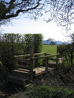
The Sandstone Trail and Beeston Castle. The trail crosses this bridge stile and then veers left to cross the next field. The halfway point on the trail is Beeston Castle, which is disguised by the prominent tree on the far side of the field.
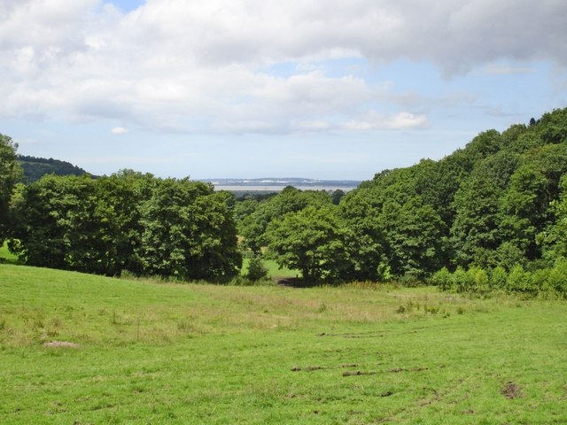
Frodsham viewed from the Sandstone Trail. Helsby Hill and the A56 main road are in the middle distance. The Kemira fertiliser plant and the Shell Stanlow oil refinery are in the distance
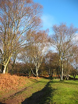
Sandstone Trail on Bickerton Hill. The trail at this point forms a sunken track, with open grassland to the east (right) and heathland with scattered birches to the west (left). View northwards, near the crossroads with a minor path, on a sunny autumn morning
Elevation Profile


