Scout Dike, Royd Moor and Ingbirchworth Reservoirs
![]()
![]() This walk visits these three pretty reservoirs near Barnsley. The route makes use of the Penistone Boundary Walk and the Barnsley Boundary Walk to cross Royd Moor and visit each of the reservoirs in turn. It's a lovely area with the reservoirs surrounded by attractive countryside and views to the surrounding Yorkshire hills.
This walk visits these three pretty reservoirs near Barnsley. The route makes use of the Penistone Boundary Walk and the Barnsley Boundary Walk to cross Royd Moor and visit each of the reservoirs in turn. It's a lovely area with the reservoirs surrounded by attractive countryside and views to the surrounding Yorkshire hills.
The walk starts from the car park at Scout Dike Reservoir, just off the A629. The trail then runs along the western side of the water to Royd Moor before heading north to Ingbirchworth Moor and the final reservoir.
To extend your walk you can continue along the Barnsley Boundary Walk to the smaller Broadstone Reservoir. It's located about half a mile west of Ingbirchworth Reservoir. The trail eventually reaches Holmfirth, passing Scholes on the way.
Heading north east along the trail would take you to Gadding Moor and Cannon Hall Country Park.
Scout Dike, Royd Moor and Ingbirchworth Reservoirs Ordnance Survey Map  - view and print off detailed OS map
Scout Dike, Royd Moor and Ingbirchworth Reservoirs Open Street Map  - view and print off detailed map
Scout Dike, Royd Moor and Ingbirchworth Reservoirs OS Map  - Mobile GPS OS Map with Location tracking
Scout Dike, Royd Moor and Ingbirchworth Reservoirs Open Street Map  - Mobile GPS Map with Location tracking
Pubs/Cafes
Just to the east of the reservoirs you'll find Yummy Yorkshire where they have a cafe and a restaurant with a great menu. They also make all their own delicious ice cream with dairy from the adjacent farm. It's housed in an attractive building and well worth a visit after your walk. You can find it at Delph House Farm, Denby Dale with a poostcode of HD8 8XY for your sat navs.
If you prefer a more traditional pub then the George Inn is worthy of investigation. They also organise Pie & Pea Walks heading off from The George on foot with a reward of Homemade Pie, Peas and Roast Potatoes waiting for you on your return. The inn has a cosy interior and a nice beer garden for warmer days. It's also dog friendly. You can find the pub at 114 Denby Ln, Upper Denby, HD8 8UE.
Further Information and Other Local Ideas
Just to the west there's the worthy village of Hepworth where you'll find the Butcher's Arms. The pub dates back to the early 1800s and is notable for featuring in the long running tv show Last of the Summer Wine. Many scenes from the show were shot around the village with the characters often meeting up in the pub.
You can find them at postcode HD9 1TE for your sat navs.
The Hepworth Walk visits the reservoirs from the village.
Cycle Routes and Walking Routes Nearby
Photos
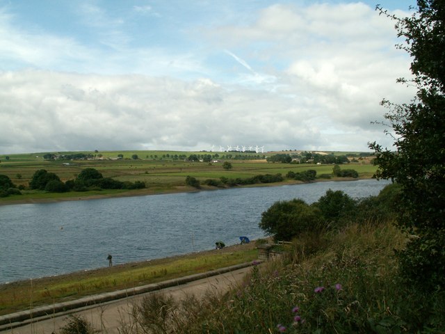
Scout Dike Reservoir taken from the car park. Royd Moor wind turbines can be seen off centre right on skyline.
Royd Moor Reservoir. A spring time view across the meadows of Royd Moor Farm from Royd Moor Road. Ingbirchworth village is in the distance on the left, with the white building of the former Rose and Crown pub, the last house in the village (going south) visible.
Scout Dike Reservoir. Young canoeists from the nearby Kingswood Peak Venture outdoor educational activity centre. Photo taken from the shore path adjacent to the parking access area of Barnsley Trout Club.


