Scout Scar
![]()
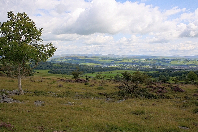
![]() Enjoy a short but steep climb to a wonderful viewpoint near Kendal. There's a good footpath leading up to the viewpoint where you can see the Coniston Old Man, Bowfell and the Langdale Pikes. It's a geologically fascinating area with carboniferous limestone and steep slopes to admire.
Enjoy a short but steep climb to a wonderful viewpoint near Kendal. There's a good footpath leading up to the viewpoint where you can see the Coniston Old Man, Bowfell and the Langdale Pikes. It's a geologically fascinating area with carboniferous limestone and steep slopes to admire.
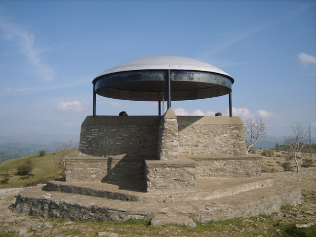
There is a car park on Underbarrow Road just to the north west of the hill. You can follow the road from Kendal to the site. It's about 2 miles west of the town centre. From here you can pick up the footpaths to take you up to Scout Scar and along Barrowfield Wood. At the 235m (775ft) summit you will find a structure known as 'The Mushroom'. This shelter has a view finder (toposcope) showing all the fells you can see from the viewpoint.
You can explore the area further by visiting Cunswick Scar and Helsington Barrows as shown in the video below. The longer circular walk starts in Kendal and visits the Lake District's outlying fells as described by Alfred Wainright in the first chapter of his book on the area.
If you continue south from this route you will soon come to Sizergh Castle. The 1,600-acres estate includes miles of great walking trails through limestone pasture, orchards and Brigsteer Woods.
In Kendal itself you could try our Kendal Castle and River Walk which visits the atmospheric ruins of the 12th century castle and also takes you along the River Kent.
Postcode
LA8 8HB - Please note: Postcode may be approximate for some rural locationsScout Scar Ordnance Survey Map  - view and print off detailed OS map
Scout Scar Open Street Map  - view and print off detailed map
Scout Scar OS Map  - Mobile GPS OS Map with Location tracking
Scout Scar Open Street Map  - Mobile GPS Map with Location tracking
Pubs/Cafes
Just to the south of the Scar you'll find the little village of Brigsteer where you can visit the excellent Wheatsheaf Inn. The historic inn dates back to the 1880s and has a babbling brook running beneath it. There's a fine interior with log fires, cosy corners and a lovely sunny conservatory. Outside there's a nice garden area for warmer weather. They serve an excellent Sunday roast and also provide quality rooms if you'd like to stay in the area.
Near here you could visit the noteworthy Helsington Church. There's some excellent views over the Lyth Valley from the 18th century church.
Further Information and Other Local Ideas
Another similar climb near Kendal can be found east of the town centre where you will find Hay Fell and it's peak of Benson Knott. The walk includes a stroll along the River Mint before climbing to the 319m / 1047ft summit.
For more walking ideas in the area see the Lake District Walks page.


