Sharnbrook Walks
![]()
![]() This pretty Bedfordshire village has some pleasant riverside trails, a Norman church and a local nature reserve to explore. There's also a delightful mill theatre converted from the historic old water mill.
This pretty Bedfordshire village has some pleasant riverside trails, a Norman church and a local nature reserve to explore. There's also a delightful mill theatre converted from the historic old water mill.
This walk from the village take you to the Felmersham Nature Reserve before visiting the neighbouring settlement of Felmersham.
The reserve lies just south west of Sharnbrook and includes a series of pools with lots of water loving wildlife to see. You can also enjoy a walk along the River Ouse to cross at Felmersham Bridge and visit Felmersham which lies on the southern side of the river.
To continue your walking in the area head south to Pavenham where you can pick up the John Bunyan Trail. You could then follow it south to visit nearby Stevington, Bromham and the splendid Bedford Park.
Postcode
MK44 1PF - Please note: Postcode may be approximate for some rural locationsSharnbrook Ordnance Survey Map  - view and print off detailed OS map
Sharnbrook Open Street Map  - view and print off detailed map
Sharnbrook OS Map  - Mobile GPS OS Map with Location tracking
Sharnbrook Open Street Map  - Mobile GPS Map with Location tracking
Walks near Sharnbrook
- Stevington - This route uses sections of the John Bunyan Trail and the Ouse Valley Way to create a circular walk around the Bedfordshire village of Stevington.
- Harrold Odell Country Park - This park has two pretty lakes set in 144 acres of country park
- Felmersham - This small Bedfordshire based village is located in a pleasant rural spot on the River Great Ouse, just south of Sharnbrook.
- Bromham - This walk explores Bromham Park and the Bromham Mill Nature Reserve on the eastern side of this pretty Bedfordshire based village
- Bedford Purlieus National Nature Reserve - These splendid ancient woods near Peterborough have miles of woodland walking trails to try
- Bedford Park - Enjoy an easy stroll around this pretty park near the centre of Bedford
- Bedford to Sandy - This lovely route follows National Cycle routes 12 and 51 and the Bedford to Sandy Country Way - an off road path perfect for walking or cycling
- Turvey - This attractive Bedfordshire village is situated in a lovely rural spot close to the River Great Ouse.
- Great Barford - This Bedfordshire based village has some delightful riverside walking trails
- John Bunyan Trail - Follow in the footsteps of John Bunyan, the Puritan Evangelist and author of the book 'Pilgrim's Progress'
- Ouse Valley Way - Follow the River Great Ouse from the source at Brackley, Northamptonshire, to the mouth at The Wash at King's Lynn
- North Bedfordshire Heritage Trail - A super circular walk around the North Bedfordshire countryside visiting twenty three villages, two country parks and around thirty public houses.
Pubs/Cafes
Back in the village you can enjoy some post exercise relaxation and refreshment at the splendidly named Swan with Two Nicks. They do fine home cooked food and have a rear courtyard and patio garden for warmer weather. You can find them on the High Street at postcode MK44 1PF for your sat navs.
Dog Walking
The trails make for a pleasant dog walk. Please keep them on leads around the Felmersham Gravel Pits reserve. The Swan pub mentioned above is also dog friendly.
Further Information and Other Local Ideas
The North Bedfordshire Heritage Trail passes through the village. The long distance circular walk explores the North Bedfordshire countryside visiting twenty three villages, two country parks and around thirty public houses. You could pick it up and follow it to Harrold Odell Country Park which lies just to the west.
For more walking ideas in the area see the Bedfordshire Walks page.
Photos
Wildlife Ponds at Felmersham. The several ponds at Felmersham are managed by the County Wildlife Trust and are open to the public. The trackway shown above and other footpaths extend around most of the tree-lined ponds which are formed from old gravel workings. The area is excellent for walking with car parking available at SP987583.
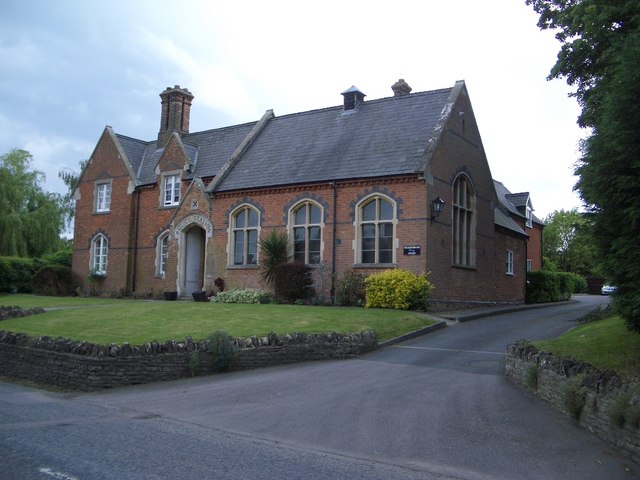
Former Police Station at Sharnbrook. As can be seen from the inscription over the doorway this solid fine looking Victorian building with polychromatic brickwork detail was once the village police station, now in alternative ownership.


