Shincliffe Walks
![]()
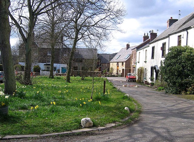
![]() This small village near the city of Durham has some peaceful local woods and riverside trails to try. The historic village is one of the most affluent in the county and has been designated a conservation area. Features include a mediaeval bridge over the river and the 18th century Shincliffe Hall in the wood.
This small village near the city of Durham has some peaceful local woods and riverside trails to try. The historic village is one of the most affluent in the county and has been designated a conservation area. Features include a mediaeval bridge over the river and the 18th century Shincliffe Hall in the wood.
This circular walk from the town visits Shincliffe Wood and the River Wear before heading to Croxdale Wood, Croxdale Hall and Sunderland bridge. It's a lovely area with lots of peaceful woodland trails, lakes, ponds and fine views of the river and surrounding countryside.
The walk starts in the village and then heads north west towards Shincliffe Bridge where you can pick up the Weardale Way. Follow the waymarked path south and it will take you to the riverside Shincliffe Wood. You continue towards Butterby Wood and Croxdale Wood before passing Croxdale Hall and Sunderland Bridge. You then head east past Annie's Wood lake before following the Strawberry Lane Bridle path north back to the village.
Shincliffe Ordnance Survey Map  - view and print off detailed OS map
Shincliffe Open Street Map  - view and print off detailed map
Shincliffe OS Map  - Mobile GPS OS Map with Location tracking
Shincliffe Open Street Map  - Mobile GPS Map with Location tracking
Walks near Shincliffe
- Weardale Way - Follow the River Wear from the coast at Sunderland to Killhope Lead Mining Museum in the Pennines
- Brandon - Bishop Auckland Walk - This is a nice easy cycling and walking path that follows a disused railway line from Brandon, near Durham to Bishop Auckland.
You will pass through the villages of Brancepeth and Willington, shortly before joining the River Wear for the final stretch into Bishop Auckland - Lanchester Valley Walk - This shared cycling and walking path uses the route of the railway originally built to carry iron ore to Consett Steelworks
- Deerness Valley Railway Path - This cycle or walk along a dismantled railway line runs from Stonebridge to Crook through the beautiful Deerness Valley
- Weardale Way - Follow the River Wear from the coast at Sunderland to Killhope Lead Mining Museum in the Pennines
- Durham Riverside Walk - This splendid walk around Durham visits many of the city highlights including the River Wear, Durham Castle, the cathedral, Old Durham Gardens and the Durham Botanical Gardens
- Whitworth Hall Country Park - Explore 73 acres of parkland surrounding the Grade II listed stately mansion of Whitworth Hall in Spennymoor
Pubs/Cafes
The Rose Tree Inn is located in a fine spot next to the River Wear. There's a lovely large garden area and an extensive menu to choose from. You can find them at Low Road West with a postcode of DH1 2NU for your sat navs.
Dog Walking
The woodland trails are ideal for dog walking and the Rose Tree Inn mentioned above is also very dog friendly with water, treats and a doggy menu available.
Further Information and Other Local Ideas
The village is located just to the south of Durham where you can try the Durham Riverside Walk. The route visits many of the city's highlights including the River Wear, Durham Castle, the cathedral, Old Durham Gardens and the Durham Botanical Gardens. Near here there's also Houghall Woods where there's lots of pretty bluebells in the spring months.
In nearby Spennymoor you could visit Whitworth Hall Country Park and enjoy afternoon tea at the delightful old country house. There's also lovely parkland and gardens to explore with a large herd of deer you can hand feed.
For more walking ideas in the area see the County Durham Walks page.
Photos
The Path through Butterby Wood. The path shown in the picture leads down-hill from Butterby Farm to the eastern bank of the River Wear.


