Solva to Newgale Walk
![]()
![]() This walk follows a lovely section of the Pembrokeshire Coast Path from Solva to Newgale. The route runs for about 4 miles along a waymarked, undulating coastal path.
This walk follows a lovely section of the Pembrokeshire Coast Path from Solva to Newgale. The route runs for about 4 miles along a waymarked, undulating coastal path.
The walk starts from Solva Harbour and heads south towards St Elvis Rock. You then head east to the headland at Dinas Fawr. There is a footpath that heads out across the headland but do take care if you follow this path. There's great views towards the islands of Green Scar and Ramsey Island from here. Pretty heather can also be found in this area at the right times of year.
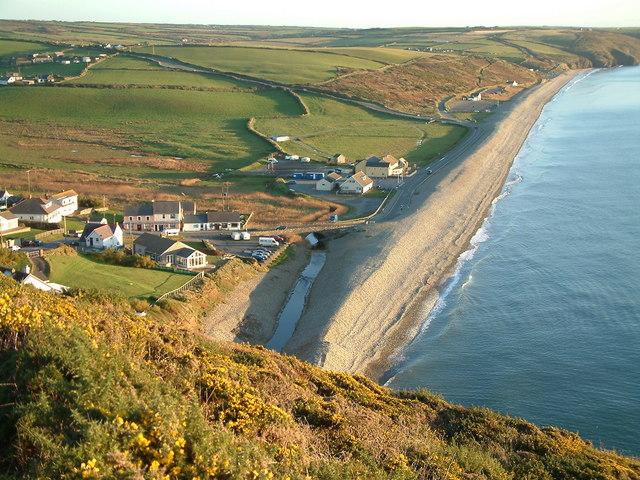
The route continues east past the sister headland of Dinas Fach, before passing a series of caves and arriving at Newgale. Here you'll find a wonderful 2 mile stretch of beach which is popular with windsurfers, surfers and canoeists throughout the summer months. Newgale also marks the boundary between English and Welsh-speaking Pembrokeshire, with the next beach north of Newgale being called Pen-y-Cwm.
To continue your walking in the area you could try the Solva Harbour Walk. The Solva to St Davids Coastal Walk takes you in the other direction along the coast path.
Solva to Newgale Walk Ordnance Survey Map  - view and print off detailed OS map
Solva to Newgale Walk Open Street Map  - view and print off detailed map
Solva to Newgale Walk OS Map  - Mobile GPS OS Map with Location tracking
Solva to Newgale Walk Open Street Map  - Mobile GPS Map with Location tracking
Pubs/Cafes
You could head to the Duke Of Edinburgh Inn for some refreshments at the end of the walk. The pub has a nice outdoor seating area with good views of the surrounding area. You can find the pub overlooking St. Brides Bay, about a 5 minute walk from the beach at postcode SA62 6AS.
In Solva there's the Harbour Inn to try. The friendly pub is in a great position overlooking the picturesque harbour. The pub has a good menu and some tables outside. It is also dog friendly. You can find it at 31 Main Street with a postcode of SA62 6UT.
The Cafe on the Quay is also beautifully located on Trinity Quay in Solva. You can sit outside on the balcony an enjoy wonderful views of the estuary with your lunch. You can find it at postcode SA62 6UQ.
Further Information and Other Local Ideas
If you continue south along the coast path you could visit Broad Haven where there's a lovely blue flag beach, natural arches and a fine beach front bar to visit.
Cycle Routes and Walking Routes Nearby
Photos
Dinas Fawr and Pen Dinas. Looking east along the coast from the 'summit' of Dinas Fawr headland. The dramatic heather-clad peninsula of Dinas Fawr is about a mile southeast of Solva, Pembrokeshire. A public right of way leads from the long-distance coastpath along the knife-edge ridge to the tip of the headland. However, this path is exposed, rough-surfaced and precipitous so it is unsuitable for walkers who are not sure-footed and agile.
Dinas Fawr viewed from the Pembroke coast path. Green Scar can be seen beyond, and on the skyline is Ramsey Island.
Dinas Fach 'Dinas' meaning city, 'Fach' meaning small. City is an unusual name for a rural/ coastal area but there are a few Dinas names around. The meaning could be inferred as meaning a 'town' or camp, but not as we know them today. In the Iron Age the coastline was dotted with well defended promontory forts. Dinas Fawr is referred to as Iron Age in the Historical Environments Report but was described by the Royal Commission for Ancient Monuments in Wales as " An extensive hog-back promontory where a bank and ditch has been observed (RCAHM Pembs 1925)but not subsequently confirmed. Hollows on the promontory are thought to represent small-scale copper mining rather than occupational features".
Magical Newgale. The silhouetted cliffs look dark and brooding but the beach was simply glowing in the weak, winter sun. One point of interest - the distinct shape of Rickett's Head promontory is man made, carved out of the cliff by the mining activity of previous centuries.The coal in the area was particularly pure and smoked very little. Queen Victoria used to burn the coal from the Trefrane seam at Sandringham.


