Sorrel Hill Walk
![]() This walk climbs to Sorrel Hill in the Wicklow Mountains near Blessington.
This walk climbs to Sorrel Hill in the Wicklow Mountains near Blessington.
The route follows the Mass Path to the 600 metre hill summit where you can enjoy some wonderful views over the surrounding lakes and mountains.
The path itself has long associations with local communities, once used by people travelling across the uplands to attend Mass, and today it provides a clear route through open moorland and heath. As you gain height, the views gradually open out across the central Wicklow range, with Lough Dan, Lough Tay and the Blessington Lakes visible on clear days, alongside the peaks of Kippure, Seefin and Mullaghcleevaun. The broad slopes are covered in heather and grasses, with skylarks often heard overhead and occasional sightings of red grouse in the upland habitat.
At the summit, marked by a trig point, the panorama is wide and rewarding, stretching west towards the plains of Kildare and east towards the heart of the Wicklow Mountains. The openness of the hill gives a strong sense of space and exposure, with the wind often sweeping across the ridge.
The descent retraces the same historic path, allowing time to take in the landscape from a different perspective, with the lakes below framed by rolling hills and patchwork farmland. The combination of history, natural beauty and far-reaching views makes Sorrel Hill a fine choice for a shorter mountain walk within easy reach of Blessington.
The start point is near the Blessington Lakes Walk where you can enjoy a stroll along the expansive Poulaphouca Reservoir. The Seefin Passage Tomb Walk is also nearby and well worth a look.
Sorrel Hill Walk Open Street Map  - view and print off detailed map
Ireland Walking Map - View All the Routes in the Country>>
*New* - Walks and Cycle Routes Near Me Map - Waymarked Routes and Mountain Bike Trails>>
Sorrel Hill Walk Open Street Map  - Mobile GPS Map with Location tracking
Cycle Routes and Walking Routes Nearby
Photos
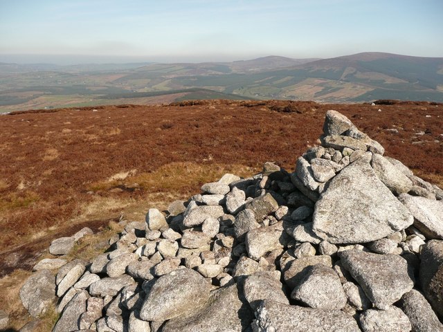
Cairn at Sorrel Hill. An interesting cairn which is built in two levels. There is a circular platform about a metre or so high and of fairly regular construction and on top of this is the more typical collection of stones forming the cairn.


