South Zeal Walks
![]()
![]() This attractive Devon based village is located in the Dartmoor National Park next to the village of Sticklepath.
This attractive Devon based village is located in the Dartmoor National Park next to the village of Sticklepath.
This circular walk from South Zeal takes you to the viewpoint on Ramsley Hill before exploring the heathland on the slopes of Cosdon Hill to the west of the settlement. From the high points there are some splendid views over the surrounding hills and countryside.
To continue your walking in the area head into Sticklepath where there are nice views of the River Taw and the National Trust's Finch Foundry. The 19th-century water-powered forge includes a water wheel and demonstrations of the historic tilt hammer, drop hammer, and shear hammer tools.
Postcode
EX20 2LB - Please note: Postcode may be approximate for some rural locationsSouth Zeal Ordnance Survey Map  - view and print off detailed OS map
South Zeal Open Street Map  - view and print off detailed map
South Zeal OS Map  - Mobile GPS OS Map with Location tracking
South Zeal Open Street Map  - Mobile GPS Map with Location tracking
Walks near South Zeal
- Sticklepath - The village of Sticklepath is located in a lovely spot on the River Taw in the north eastern section of Dartmoor National Park
- Dartmoor Way - This epic long distance circular walk takes you on a tour of the wonderful Dartmoor National Park.On the circular route you will pass Okehampton, Chagford, Moretonhampstead, Buckfastleigh, Princetown, Foggintor Quarry and Tavistock as you make your way around this circular route
- Tarka Trail - This wonderful walk through Devon follows the path taken by Tarka the Otter in the book of that name
- Taw Teign Link - This short walk takes you through the beautiful Dartmoor National Park and links the Tarka Trail and Two Moors Way.The walk begins near the River Taw in Sticklepath and heads through South Zeal before climbing Ramsley Hill where you can enjoy fabulous views of Dartmoor
- High Willhays - Climb to the highest point on Dartmoor on this splendid circular walk in the Dartmoor National Park
- Yes Tor - This circular walk climbs to Yes Tor from Meldon Reservoir in the Dartmoor National Park
- Belstone - This pretty Devon village is located in a lovely spot on Dartmoor
- Scorhill Stone Circle - This walk visits the Scorhill Stone Circle and the Wallabrook Clapper Bridge in the Teign Valley of Dartmoor.
Pubs/Cafes
The Oxenham Arms has an interesting history having originally been a 12th-century monastery. The country inn has a charming interior with low beams, flagstone floors and open fires. Outside there's a nice garden area for warmer weather. You can find them at postcode EX202JT for your sat navs. The pub also has a car park and is dog friendly.
Photos
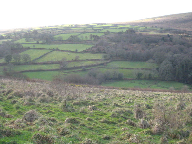
Fields on slopes of Cosdon Hill Evening sunlight bathes this northeast corner of Dartmoor, seen from South Tawton Bridleway 21. The fields around Ash Farm in the middle distance across the valley are in SX6592.
Two paths, Ramsley Hill. These paths cross the southwestern area of a grassy area of the hill - most of the hill, especially the steeper edges, is dominated by bracken and bramble. The hill has no officially numbered rights of way across it, but is nonetheless crossed by the Dartmoor Way and the Taw-Teign Link, which appear to share the path I was following when I took this. Seen in late sunlight.


