Southend Circular Coastal Walk Map
![]()
![]() Enjoy the coastline and surrounding countryside of this famous seaside resort on this interesting circular walk.
Enjoy the coastline and surrounding countryside of this famous seaside resort on this interesting circular walk.
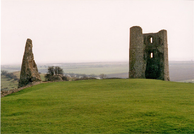
You will pass beaches, the famous Golden Mile with its numerous tourist attractions and the longest pier in the world on the coastal stretch which starts at Southend Tourist Information Centre. Highlights on the walk include Southend's pretty cliff gardens near the start. The elevated park includes formal and informal gardens with beautiful views across the Thames Estuary. You'll also visit Hadleigh Country Park and the ruins of the 13th century Hadleigh Castle before heading inland through the attractive Essex Countryside, passing through Rochford on the way. You then return to the coast for another pleasant coastal stretch through Thorpe Bay before finishing back at the Tourist information centre in Southend.
To continue your walking in the area you can try the Benfleet to Leigh on Sea Walk which visits the sea wall on Hadleigh Marshes. The route also passes close to Two Tree Island which is located just a short stroll from Leigh on Sea. The expansive nature reserve includes lagoons, pretty streams and great views across Hadleigh Ray to Canvey Island.
If you were to continue east along the coast you would soon come to Shoeburyness. It's an interesting place for a walk with a beach, interesting old buildings, a nature reserve and the Shoebury Old Ranges to explore.
Southend Millennium Walk Ordnance Survey Map  - view and print off detailed OS map
Southend Millennium Walk Open Street Map  - view and print off detailed map
*New* - Walks and Cycle Routes Near Me Map - Waymarked Routes and Mountain Bike Trails>>
Southend Millennium Walk OS Map  - Mobile GPS OS Map with Location tracking
Southend Millennium Walk Open Street Map  - Mobile GPS Map with Location tracking
Further Information and Other Local Ideas
To the north you can pick up the circular Roach Valley Way. This waymarked trail will take you around the neighbouring town of Rochford visiting Hockley Woods on the way. The trail also comes close to the RSPB reserve on Wallasea Island and the pretty village of Paglesham.
Just to the north east there's the historic village of Great Wakering where there's a noteworthy Norman Church and some lovely waterside footpaths along the local creeks.
Just to the north east you will find some fine woodland trails around Belfairs Woods and Hadleigh Great Wood. The area is also a nature reserve with a discovery centre and lots of wildlife to see.
For more walking ideas in the area see the Essex Walks page.
Cycle Routes and Walking Routes Nearby
Photos
Southend Seafront and Pier. Early evening along Southend seafront. The Pier is open again (August 2006) after being closed for nine months because of a disastrous fire. In the middle distance is part of the Adventure Playground complex
Elevation Profile


