St Catherine's Hill Christchurch
![]()
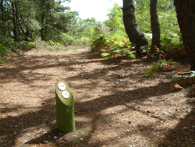
![]() This hill to the north of Christchurch stands at 53-metres (174 ft). A climb to the top is rewarded with super views of the surrounding countryside and the River Avon with the coast and the Isle of Wight beyond. As well as the great views the area is covered with attractive heathland and coniferous forest to explore. There's also an abundance of wildlife with Dartford Warbler, Sand Lizard, Smooth Snake, Adder, Nightjar, Hobby, Grayling, Silver-studded Blue, Scarce Chaser and White-legged Damselfly to look out for. It's easy to extend your walk by picking up a footpath north to Town Common and Blackwater Hill where there are great views over the River Stour. Just beyond Blackwater Hill is the Sopley Common Nature Reserve. Here you'll find dry heathland, covered with purple heather, and a variety of wildlife including lizards & smooth snakes, heath grasshoppers, wood tiger beetle & grayling butterfly. All in all St Catherine's Hill and the area around it makes for a splendid long or short walk.
This hill to the north of Christchurch stands at 53-metres (174 ft). A climb to the top is rewarded with super views of the surrounding countryside and the River Avon with the coast and the Isle of Wight beyond. As well as the great views the area is covered with attractive heathland and coniferous forest to explore. There's also an abundance of wildlife with Dartford Warbler, Sand Lizard, Smooth Snake, Adder, Nightjar, Hobby, Grayling, Silver-studded Blue, Scarce Chaser and White-legged Damselfly to look out for. It's easy to extend your walk by picking up a footpath north to Town Common and Blackwater Hill where there are great views over the River Stour. Just beyond Blackwater Hill is the Sopley Common Nature Reserve. Here you'll find dry heathland, covered with purple heather, and a variety of wildlife including lizards & smooth snakes, heath grasshoppers, wood tiger beetle & grayling butterfly. All in all St Catherine's Hill and the area around it makes for a splendid long or short walk.
To extend your walk you could visit Christchurch Harbour and Hengistbury Head where there are more great views of the area.
Postcode
BH23 2SP - Please note: Postcode may be approximate for some rural locationsSt Catherine's Hill Christchurch Ordnance Survey Map  - view and print off detailed OS map
St Catherine's Hill Christchurch Open Street Map  - view and print off detailed map
St Catherine's Hill Christchurch OS Map  - Mobile GPS OS Map with Location tracking
St Catherine's Hill Christchurch Open Street Map  - Mobile GPS Map with Location tracking
Further Information and Other Local Ideas
Head north from the hill and you could visit Sopwith Common and the Ramsdown Plantation. There's another nice viewpoint here and lots of pretty heather in the late summer. Just beyond that is Hurn Forest where there are miles of good walking and cycling trails next to Bournemouth Airport.
Cycle Routes and Walking Routes Nearby
Photos
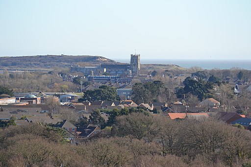
St Catherine's Hill, Christchurch View from near the hilltop looking east; Avon river in the distance
Heather on the northern slopes of St Catherine's Hill in July. This path leads up to a tumulus at the northern end of St Catherine's Hill, a raised area between the River Stour to the west and the River Avon to the east. The final part of the path is steep and well eroded and water has carved a gulley into the sandy hillside.


