Staffhurst Wood
![]()
![]() This woodland area near Tandridge is popular with walkers in spring when there are carpets of pretty bluebells and a nice woodland pond to see. There are a number of trails to follow around the woods with the option of extending your walk into the adjacent Great Earls Wood and Merle Common. You can enjoy refreshment at the nearby Royal Oak Pub after your walk.
This woodland area near Tandridge is popular with walkers in spring when there are carpets of pretty bluebells and a nice woodland pond to see. There are a number of trails to follow around the woods with the option of extending your walk into the adjacent Great Earls Wood and Merle Common. You can enjoy refreshment at the nearby Royal Oak Pub after your walk.
There is a car park at the woods but if you wanted to visit the woods by train you could follow the Eden Valley Walk and the Vanguard Way from Edenbridge towards the woods.
The woods are run by Surrey Wildlife Trust and this circular walk runs for about 1 mile.
Postcode
TN8 6QF - Please note: Postcode may be approximate for some rural locationsStaffhurst Wood Ordnance Survey Map  - view and print off detailed OS map
Staffhurst Wood Open Street Map  - view and print off detailed map
Staffhurst Wood OS Map  - Mobile GPS OS Map with Location tracking
Staffhurst Wood Open Street Map  - Mobile GPS Map with Location tracking
Pubs/Cafes
Head west and you can enjoy refreshments at The Royal Oak/Grumpy Mole in Oxted. There's good food and a lovely garden area backing onto the surrounding fields. You can find them at postcode RH8 0RR for your sat navs.
Dog Walking
The woods are ideal for dog walking so you'll probably see other owners on a fine day. The Grumpy Mole mentioned above is also dog friendly.
Further Information and Other Local Ideas
The woods are located close to the interesting village of Lingfield. Here you'll find several listed tudor buildings and a 13th century church. The circular Lingfield Walk starts from the village and visits Hedgecourt Lake and one of the highlights of the area at the British Wildlife Centre. At this popular local attraction you'll find over 40 species of British wildlife, including foxes, red squirrels, red deer, roe deer, red weasels, badgers, river otters, hedgehogs and Scottish wildcats. There's also a wetlands area with a number of walkways and footpaths to follow around the site.
For more walking ideas in the area see the Surrey Walks page.
Cycle Routes and Walking Routes Nearby
Photos
Staffhurst was part of the "wildwood" that once covered most of England. Trees were felled in the 1930's and damaged again during World War Two when it was used as a vast ammunition dump. Today the woodland is back to its former character and is designated a local nature reserve and a Site of Special Scientific Interest. This photograph taken in May shows the bluebells in the wood.
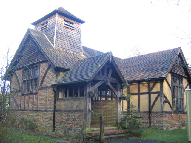
St Silvan's House, Staffhurst Wood Road, Limpsfield, seen from the southwest. Built in the 19th century as a mission room and consecrated in 1930 as a church. Remodelled in 1976 to convert part of the building into living accommodation for the priest. Now redundant and turned into a private house.


