Staines Moor
![]()
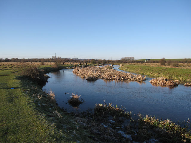
![]() This walk takes you across the Staines Moor Site of Special Scientific Interest in Surrey. The walk follows the Colne Valley Way from the River Thames in Staines to Wraysbury Reservoir, near Horton. You'll enjoy nice views of the River Colne and the King George VI Reservoir as you pass across the moor. You'll also pass through the village of Stanwell Moor before walking alongside Wraysbury Reservoir. You can return on the same path or there is a footpath along the Wraysbury River. This would take you back into Staines and turn it into a circular walk.
This walk takes you across the Staines Moor Site of Special Scientific Interest in Surrey. The walk follows the Colne Valley Way from the River Thames in Staines to Wraysbury Reservoir, near Horton. You'll enjoy nice views of the River Colne and the King George VI Reservoir as you pass across the moor. You'll also pass through the village of Stanwell Moor before walking alongside Wraysbury Reservoir. You can return on the same path or there is a footpath along the Wraysbury River. This would take you back into Staines and turn it into a circular walk.
The moor is a very pretty area with unimproved grassland which is covered in pretty wildflowers in the summer months. There's also a series of streams, rivers, ponds and lakes attracting birdlife such as tufted ducks, pochard, goosander and common goldeneye. On the rich pasture of the moor you can also see grazing horses and cattle.
The start of the walk can be reached from car parks in the centre of Staines or from the nearby Staines train station.
To extend your walk you could continue along the Colne Valley Way to Colnbrook. You can also pick up the Thames Path and enjoy a riverside stroll to Windsor.
Just to the south west of the moor you can head to Runnymede Park and visit the birthplace of the Magna Carta.
Postcode
TW19 6ED - Please note: Postcode may be approximate for some rural locationsStaines Moor Ordnance Survey Map  - view and print off detailed OS map
Staines Moor Open Street Map  - view and print off detailed map
Staines Moor OS Map  - Mobile GPS OS Map with Location tracking
Staines Moor Open Street Map  - Mobile GPS Map with Location tracking
Further Information and Other Local Ideas
Just to the south west of Wraysbury Reservoir you will find the pretty village of Wraysbury. Here there's a nice walk to the National Trust's Ankerwycke where there's an ancient yew and a ruined priory to see. There are also views across Magna Carte island to Runnymede and a fine 16th century village pub to visit.
A couple of miles to the east you'll find the popular Bedfont Lakes Country Park. There's lakeside paths with large numbers of birdlife to see here.
For more walking ideas in the area see the Surrey Walks page.


