Stapleford Woods
![]()
![]() This area of ancient woodland near Newark on Trent has some nice footpaths taking you around the forest. In the woods you will find large Victorian era-planted Rhododendrons and other interesting flora and fauna.
There is a car park off Coddington Lane where you can pick up the circular surfaced walking trail. It runs for just under a mile and is a nice way to spend half an hour.
This area of ancient woodland near Newark on Trent has some nice footpaths taking you around the forest. In the woods you will find large Victorian era-planted Rhododendrons and other interesting flora and fauna.
There is a car park off Coddington Lane where you can pick up the circular surfaced walking trail. It runs for just under a mile and is a nice way to spend half an hour.
To extend your walking in the area you could head a couple of miles west and pick up the Trent Valley Way. The lovely riverside trail runs through Newark-on-Trent and Collingham.
The woods are close to the villages of Coddington and Beckingham which are nice places to go for refreshments after your walk.
Postcode
NG24 2PB - Please note: Postcode may be approximate for some rural locationsStapleford Woods Ordnance Survey Map  - view and print off detailed OS map
Stapleford Woods Open Street Map  - view and print off detailed map
Stapleford Woods OS Map  - Mobile GPS OS Map with Location tracking
Stapleford Woods Open Street Map  - Mobile GPS Map with Location tracking
Explore the Area with Google Street View 
Pubs/Cafes
Head south west from the woods and you will soon come to the village of Coddington. Here you will find the Inn on the Green which is a great choice for some post walk refreshments. Now very much at the heart of Coddington village, The Inn on The Green was once part of a farm and maltings complex that fronted the Green. In 1948 it was put up for sale and was subsequently converted to a Country Club. The licence was changed in the 1970s and since then it has been a pub and restaurant, serving the local community and beyond. There's a very good menu and a nice outdoor seating area for warmer days. You can find the pub on Main Street with a postcode of NG24 2PS for your sat navs.
Head south east from the woods to the village of Beckingham and you can visit the Black Swan. The pub is known for its excellent food a nice atmosphere. You can find it at postcode LN5 0RQ for your sat navs.
You could also head into nearby Collingham where you'll find The Royal Oak. The friendly Community Pub has a good menu and drinks selection. There's also a large garden which has been extended and landscaped with trees, plants, patio areas and lawn. It's a lovely spot to relax in on warmer days. You can find them on Station Road with a postcode of NG23 7RA for your sat navs.
Dog Walking
The woods are a great place for dog walking with miles of wide trails to explore.
Further Information and Other Local Ideas
Just to the north west you can pick up the Collingham and Cromwell Lock Walk. The noteworthy lock includes one of the largest weirs on the Trent which marks the tidal limit of the river.
For more walking ideas in the area see the Nottinghamshire Walks page.
Cycle Routes and Walking Routes Nearby
Photos
The place for a peaceful walk which plays host to a large number of exotic trees. Stapleford is famous for its rhododendrons which are throughout the wood. These grow to impressive heights of up to 7 metres (23 ft).
A Forestry Commission mixed woodland, Stapleford Woods are famous for a large number of exotic trees and rhododendrons. There are many surfaced trails and woodland walks throughout and a large carpark off Coddington Lane, the road that goes right through the middle of the Wood.
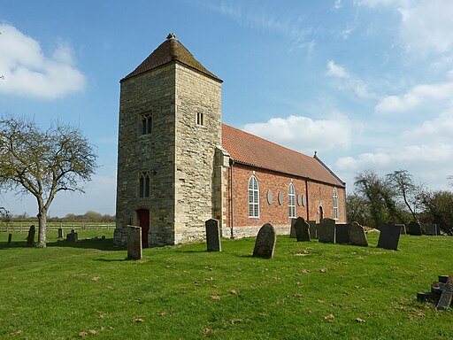
All Saints' church. This church in the village is well worth a visit. It dates to the 11th century and is Grade II listed. In the churchyard is a Grade II listed and scheduled churchyard cross which dates from the 14th century, and is believed to stand in its original position.


