Start Point Devon Lighthouse Walk
![]()
![]() This is a popular circular walk around this beautiful headland on the South Devon coast. It's about a 2 mile walk with great views over Start Bay, a visit to the lighthouse and the option of descending to a delightful secluded beach.
This is a popular circular walk around this beautiful headland on the South Devon coast. It's about a 2 mile walk with great views over Start Bay, a visit to the lighthouse and the option of descending to a delightful secluded beach.
The area is also great for wildlife watching. Look out for marine wildlife such as seals and dolphins, and birds including black-throated divers, gannets, kittiwakes and auks.
Begin the walk from the Start Point car park, near Start Farm. From here it is a short walk along the coast path to the lighthouse. On some days you can enjoy a guided tour here and climb the tower to hear stories about storms, shipwrecks and lighthouse living .
After exploring the lighthouse the walk heads along the coast path to Great Mattiscombe Sand. It is a steep climb down to the beautiful sandy cove where you can look out for Grey seals and basking sharks in the summer. The walk then heads north back to the car park.
It's easy to extend your walk if you have time. You can head west along the South West Coast Path and visit Prawle Point, the southernmost point of Devon. Heading a few miles north will take you to the splendid Slapton Ley Nature Reserve. Here you'll find the largest natural freshwater lake in South West England, a lovely shingle beach and great birdwatching opportunites.
Postcode
TQ7 2ET - Please note: Postcode may be approximate for some rural locationsStart Point Devon Ordnance Survey Map  - view and print off detailed OS map
Start Point Devon Open Street Map  - view and print off detailed map
Start Point Devon OS Map  - Mobile GPS OS Map with Location tracking
Start Point Devon Open Street Map  - Mobile GPS Map with Location tracking
Explore the Area with Google Street View 
Pubs/Cafes
Just to the north of the car park you can visit the Start Bay Inn for some post walk refreshment. The inn dates back to the 14th century and includes a thatched roof. You can sit outside on the sea front patio and enjoy fine views with a delicious seafood dish from the fine menu. You can find them in Torcross at postcode TQ7 2TQ for your sat navs.
Dog Walking
The coastal paths make for a fine dog walk and the Start Bay Inn mentioned above is also dog friendly. The surrounding fields often have livestock so it may be best to keep them on leads here.
Further Information and Other Local Ideas
The Torcross to Beesands and Start Point Walk takes you to the headland from the pretty village of Torcross. It's about a 4 mile walk from the village, passing Beesands on the way.
For more walking ideas in the area see the Devon Walks page.
Cycle Routes and Walking Routes Nearby
Photos
Start Point headland. A view from the road below the Start Farm car park, along the north side of the headland with the top of lighthouse visible in the distance. The raised beach so prominent between the point and Prawle Point is also evident.
Start Point Lighthouse. Taken from the foot of the road that leads down the north side of the headland. The lighthouse was built in "1836 by James Walker engineer, with minor alterations of 1871. Tarred and white-painted granite ashlar with cast-iron lantern roofed in copper. Tall circular tower of about 28 metres high with moulded plinth and pedestal stage and 2 diminishing stages above that, the top stage with a corbelled embattled parapet and a cast-iron lattice lantern with a copper canopy surrounded by weathervane. Rectangular and small round-headed window openings with plain raised architraves and blind panel on west side under the parapet ... lighthouse originally had the keepers' living accommodation on the ground and first floor but the floor was taken out in 1871 when new keepers' houses were built nearby ... The light was powered by oil until 1959 when it was electrified. Originally the fog-sounder was a bell mounted outside, but this was soon replaced, in about 1851, because the new steam ships could not hear the bell."
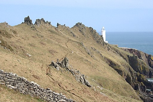
The Southern Side of Start Point. The Lighthouse is perched on the end of this wild-looking ridgeback promontory.
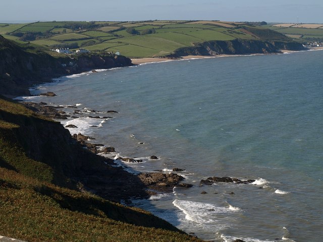
Coast northwest. A view from Nestley Point over the reefs and coves between Start Point and Hallsands. The most prominent rocks are Shoelodge Reef. The first beach is at Greenstraight, just beyond Hallsands, with Tinsey Head to the right.
Hallsands, just north of the Point. This was formerly a fishing village but is now only a collection of ruined cottages set on a rocky shelf at the cliff foot. It finally succumbed after a storm in 1917. In 1897 a contractor was given permission to take away shingle from the beach for use at Devonport.In a few years, half a million tons was removed and the beach lowered up to 3.7m(12ft) in places. Natural erosion took over, and even with concrete walls in place, nothing could beat the shingle beach as a defence.So we have a supreme example of man's folly in interfering with nature.


