Stokesley Walks
![]()
![]() This attractive market town is located in a fine position in the North York Moors National Park. There's a number of attractive Georgian and Victorian buildings and the picturesque River Leven running through the town. Here you'll also find the photogenic Pack Horse Bridge dating from the 17th Century. Also of note is the Church of St Peter and Paul, with its famous mouse woodwork carved by Robert (Mouseman) Thompson. The furniture maker set up a business manufacturing oak furniture, which featured a carved mouse on almost every piece.
This attractive market town is located in a fine position in the North York Moors National Park. There's a number of attractive Georgian and Victorian buildings and the picturesque River Leven running through the town. Here you'll also find the photogenic Pack Horse Bridge dating from the 17th Century. Also of note is the Church of St Peter and Paul, with its famous mouse woodwork carved by Robert (Mouseman) Thompson. The furniture maker set up a business manufacturing oak furniture, which featured a carved mouse on almost every piece.
This walk from the town follows the River Leven east to the neighbouring town of Great Ayton. The route runs for about 2.5 miles on a fairly flat path with nice views of the river and surrounding countryside.
Start the walk from the eastern side of the town where you can pick up a public footpath heading east along the Leven. You'll pass farmland, old bridges and a ford before arriving in the attractive village of Great Ayton. Along the way there's fine views to Roseberry Topping, one of the scenic landmarks of the area.
Stokesley Ordnance Survey Map  - view and print off detailed OS map
Stokesley Open Street Map  - view and print off detailed map
Stokesley OS Map  - Mobile GPS OS Map with Location tracking
Stokesley Open Street Map  - Mobile GPS Map with Location tracking
Walks near Stokesley
- Cleveland Way - This wonderful trail runs from Helmsley to Filey, taking you through the beautiful North York Moors national park, atop the Hambleton Hills ridge and along the stunning North Yorkshire coastline.
The trail begins in Helmsley, with the first section taking you through the heather moorland of the North York Moors, passing the village of Osmotherley, the pretty Cod Beck Reservoir and the ancient stones at Lord Stones Country Park and the Wainstones.
After enjoying the fabulous views on the elevated moors you arrive at Saltburn to begin the coastal stretch - Osmotherley - The North Yorkshire village of Osmotherley is situated on the western edge of the North York Moors National Park in the Hambleton Hills
- Cod Beck Reservoir - Enjoy a short walk around this pretty reservoir on the western edge of the North York Moors
- Hambleton Hills - This walk explores the Hambleton Hills range on the western edge of the North York Moors
- Lyke Wake Walk - The Lyke Wake Walk is a complete crossing of the North Yorkshire Moors from west to east
- Lord Stones - Visit this ancient stone and enjoy fabulous views from Cringle Moor on this exhilirating circular walk on the North York Moors
- Wainstones - Climb Hasty Bank Hill and visit the fascinating Wainstones on this circular walk in the North York Moors
- Silton Forest - Enjoy miles of mountain bike trails and footpaths in this large coniferous forest on the North York Moors
- Cleveland Way Circular Walk - Great Ayton - This lovely circular walk from Great Ayton uses public footpaths and a section of the Cleveland Way to take you to two of the highlights of the area
- Captain Cook's Monument - Enjoy a walk from Great Ayton to this iconic landmark on Easby Moor
- Roseberry Topping - Climb to the summit of this distinctive hill near Guisborough and enjoy wonderful views across the beautiful North York Moors National Park
- Carlton Bank - This walk climbs to Carlton Bank on Carlton Moor in the North York Moors National Park.
- Carlton in Cleveland - This village in North Yorkshire sits in a fine spot on the edge of the North York Moors National Park.
Pubs/Cafes
The Spread Eagle is a good choice for some post walk refreshments. They have a good menu and a lovely large garden area overlooking a stream. It's a nice place to relax on a sunny afternoon. You can find them on the 39 High Street at a postcode of TS9 5AD for your sat navs.
Dog Walking
The river trails are a nice one to do with your dog and The Spread Eagle mentioned above is also dog friendly.
Further Information and Other Local Ideas
At the end of the route you can pick up the Cleveland Way Circular Walk from Great Ayton. Here you can enjoy a climb to two of the highlights of the area at Captain Cook's Monument and Roseberry Topping.
For more walking ideas in the area see the North York Moors Walks page.
Photos
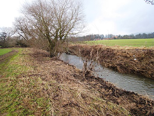
River Leven near East Angrove. This photograph shows a view of the River Leven as it makes its way in a westerly direction from Great Ayton to Stokesley. East Angrove can just be seen on the horizon. The picture was taken looking in an east-north-easterly direction towards East Angrove.
The Stone Bridge Carrying the A173 through the village of Great Ayton, bridge was built in 1909 replacing an earlier one dating from the late eighteenth century. The building reflected in the River Leven was formerly the Temperance Hotel. Opposite was Worthy Pearsons, the newsagents (first floor only visible above the bridge parapet).


