Sutton Manor Woodland and The Dream
![]()
![]() This walk visits the popular Sutton Manor Woodland Park in St Helens.
This walk visits the popular Sutton Manor Woodland Park in St Helens.
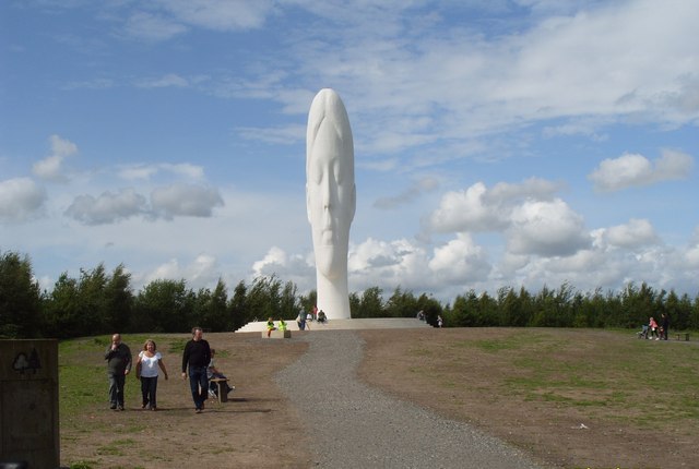
The park has been constructed on the site of the old Sutton Manor Colliery and includes a number of pleasant footpaths. On the site you'll also find a fine viewpoint with the eye catching 'Dream Sculpture' as the centrepiece of the park. The 20 metre high white sculpture is quite a sight and one of the highlights of the area.
It's easy to extend the walk by heading a short distance to the east where you'll find Clock Face Country Park. There's more well maintained paths and a lake with a fishery here. A little further afield to the west is Stadt Moers Park where there's 220 acres to explore on bike or foot.
Postcode
WA9 4BJ - Please note: Postcode may be approximate for some rural locationsSutton Manor Ordnance Survey Map  - view and print off detailed OS map
Sutton Manor Open Street Map  - view and print off detailed map
Sutton Manor OS Map  - Mobile GPS OS Map with Location tracking
Sutton Manor Open Street Map  - Mobile GPS Map with Location tracking
Further Information and Other Local Ideas
Carr Mill Dam and Sankey Valley Park are two other great options for continuing your exercise. The fine views from the top of Billinge Hill are another local highlight.
Colliers Moss Common Nature Reserve is just a couple of miles to the north east.
To the south east there's the picturesque Moore Nature Reserve. It's a lovely place for a walk with lakes, peaceful woodland and attractive meadows to explore. The reserve is also great for wildlife with a wide range of birds to look out for on the water. You can find them on the south western side of Warrington, next to the Manchester Ship Canal at postcode WA4 6XE for your sat navs.
Cycle Routes and Walking Routes Nearby
Photos
Looking Out From Sutton Manor. Looking across towards Runcorn with The power Station and Norton Water tower in the distance


