Tintern Abbey Walk
![]()
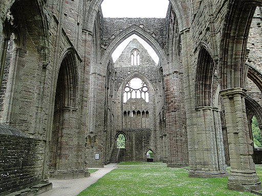
![]() Visit the fascinating ruins of this 12th century monastery and then explore the surrounding area on this walk on the England-Wales border. This route makes use of the Wye Valley Walk and Offa's Dyke Path to visit local woodlands, countryside and viewpoints. It's a beautiful area with the atmospheric ruins and the river flanked by the attractive woodland of the Forest of Dean.
Visit the fascinating ruins of this 12th century monastery and then explore the surrounding area on this walk on the England-Wales border. This route makes use of the Wye Valley Walk and Offa's Dyke Path to visit local woodlands, countryside and viewpoints. It's a beautiful area with the atmospheric ruins and the river flanked by the attractive woodland of the Forest of Dean.
The walk starts at the abbey car park and heads west along the river to the pretty village of Brockweir. Here you cross the river and head through Caswell Woods where you will find a variety of interesting flora and fauna. The path then climbs to the Devil's Pulpit where you can enjoy fabulous views back towards the abbey and over the Wye Valley. More woodland trails then take you back to the village and the car park.
It's a great area for wildlife spotting with heron, kingfisher, otter to look out for on the river. Also look out for Kestrels around the limestone rocks in Caswell Wood.
To extend your walking you can head into Lower Hale Wood just to the west of the abbey. If you follow the Wye Valley Way north it will take you to Llandogo through Bargain Wood. Here you can enjoy a visit to the picturesque Cleddon Falls on the River Cleddon.
Heading south takes you to Chepstow via Wyndcliffe Wood and the splendid Eagle's Nest viewpoint.
Postcode
NP16 6SE - Please note: Postcode may be approximate for some rural locationsTintern Abbey Ordnance Survey Map  - view and print off detailed OS map
Tintern Abbey Open Street Map  - view and print off detailed map
*New* - Walks and Cycle Routes Near Me Map - Waymarked Routes and Mountain Bike Trails>>
Tintern Abbey OS Map  - Mobile GPS OS Map with Location tracking
Tintern Abbey Open Street Map  - Mobile GPS Map with Location tracking
Explore the Area with Google Street View 
Pubs/Cafes
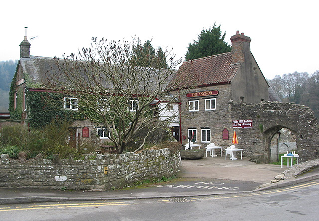
Head into the village and you could visit The Anchor for some post walk refreshment. They have a fine menu and great views towards the ancient monument from their lovely garden area. You can find them at Chapel Hill at postcode NP16 6TE for your sat navs.
Dog Walking
Dogs on leads are allowed at the abbey. The anchor mentioned above is also dog friendly.
Further Information and Other Local Ideas
Just north east of Tintern you could visit the interesting village of St Briavels. Here you will find the historic St Briavels Castle which dates back to the 12th century and is open to the public under the care of English Heritage. The village can be accessed by crossing the Bigsweir Bridge over the Wye from Llandogo in Wales to St Briavels in England on the other side.
The circular Brockweir Walk visits the station and the abbey from the nearby village. It then goes on to climb to the Devil's Pulpit.
The Wye Valley Greenway runs to the abbey from nearby Sedbury. The shared cycling and walking trail follows a disused railway line, notably passing through the murky Tidenham Tunnel on the way.
For more walking ideas in the area see the Wye Valley Walks page.
Cycle Routes and Walking Routes Nearby
Photos
Old mill wheel at Abbey Mill, Tintern village. This once turned using the power of the Angiddy stream/brook/river (depending on source). The mill was a corn mill, a woollen mill and also a sawmill. Now the various buildings have been restored to form a small shopping/dining complex.


